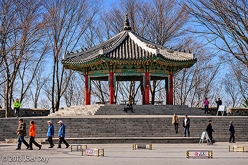
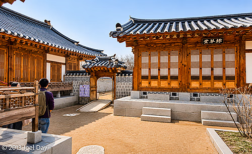
Traditional Korean Pavilion on Namsan Mountain, Near N Seoul Tower, Seoul, South Korea (2013)
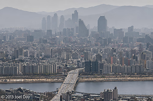
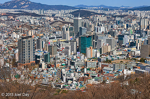
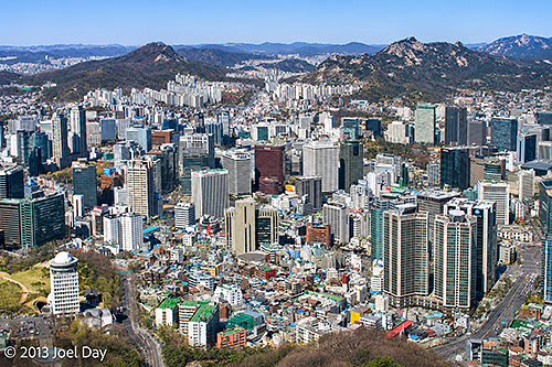
On my final day in Seoul, I sort of hit the skids. I had a lot I wanted to see, but unfortunately, since it was a Monday, most museums and palaces were closed. So I aimed for the tackiest of tourist attractions: The Space Needle – or N Seoul Tower – as the Koreans call it. It is positioned at the dead geographic centre of Seoul and is definitely geared towards young romantic couples. You could buy expensive restaurant packages for use on special floors at the top, plus a juvenile elevator ride with special space-effects video to watch on the ceiling. Plus the usual pictures to take: On arrival at the top, as a memento of the occasion (for $ of course). The view was quite extensive, although it was a bit hazy again. Seoul is a very big city of ~12,000,000 people, so it’s amazing to see it sprawled out everywhere, with mountains on the fringes and a river running through the middle.
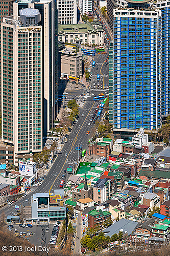
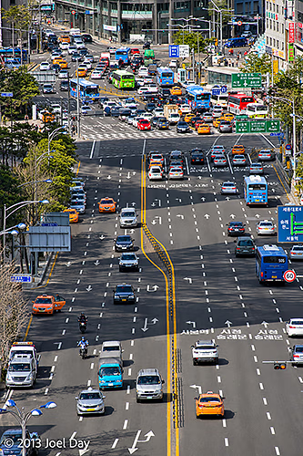
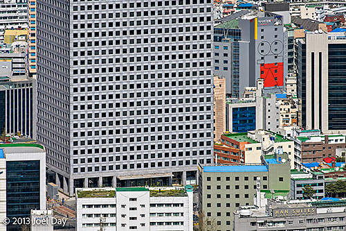
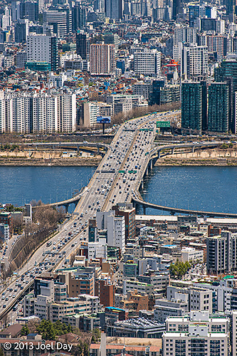
View of the Han River, Dongjak Bridge and Seoul’s Hazy Skyline from N Seoul Tower, South Korea (2013)View of the Lotte Hotel Seoul and Surrounding Streets in Myeongdong, from N Seoul Tower, South Korea (2013)Panoramic View of Central Seoul and the Surrounding Mountains from Namsan Mountain, South Korea (2013)Heavy Traffic at a Major Multi-Lane Intersection in Central Seoul, South Korea (2013)High-Rise Office Buildings and Dense Urban Development in Central Seoul, Viewed from Namsan Mountain, South Korea (2013)Dongjak Bridge (Dongjakdaegyo) Crossing the Han River, Viewed from N Seoul Tower, Seoul, South Korea (2013)Panoramic View of Downtown Seoul and the Surrounding Mountains from N Seoul Tower, South Korea (2013)
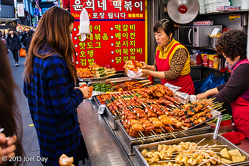
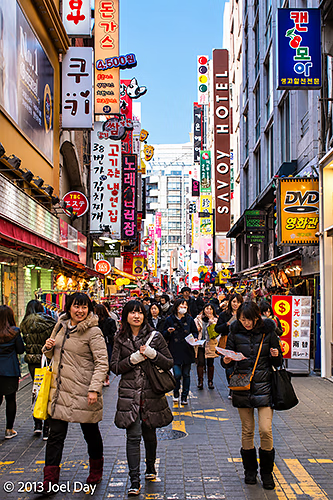
The ride to the top and bottom included a cable car that dropped you off at the bottom in an interesting neighbourhood of pedestrian shopping alleys that seemed to extend indefinitely around the city, full of little shops, restaurants, and food stalls. Maybe all of Seoul is like that. It is very nice. The variety and number of places to eat are amazing. And there are plenty of cafes to give Starbucks plenty of competition.
Street Food Stall Selling Grilled Skewers and Traditional Korean Snacks, Seoul, South Korea (2013)Busy Pedestrian Shopping Street in Myeongdong, Seoul, South Korea (2013)
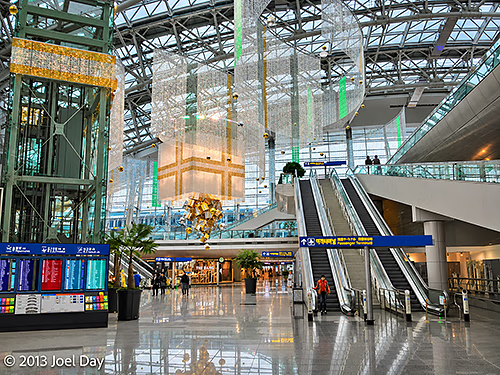
Now at the airport awaiting my flight to San Francisco, I have been very impressed with Korea and would like to come back to check out more. Very nice people, great food of every kind, excellent, slick public transportation network, world’s best airport for eight years running (or so they are claiming – it is very nice), including a great express train into the centre of town, and super-fast wifi everywhere you go (sometimes free, like everywhere here in the airport or at cafes, restaurants, museums, and hotels, or sometimes cheap at about $3 a day for access throughout the city, including the entire subway and train system). There also seems to be plenty of mountain biking, hiking, and probably paddling outside the city, as well as road biking throughout the city.
Exploring Seoul
Map of the route “On the Seoul Train”: 3,749 m, 6 m of climbing and 16 m of descent, elevation between 37 m and 55 m, time 00:51:20. It starts at 37.56078, 126.98175 and ends at 37.56802, 126.99847 (latitude, longitude).
The only downside has been the weather, which is comparable to the northeastern U.S. for this time of year: a bit colder and darker than I’m used to coming from sunny Australia.
Main Terminal Interior, Incheon International Airport, Seoul, South Korea (2013)
Flight from Seoul, South Korea to San Francisco, California
Map of the route “On the Seoul Train”: 9,703,022 m, 3,395 m of climbing and 3,019 m of descent, elevation between -40 m and 2,388 m, time 11:01:18. It starts at 37.45419, 126.44328 and ends at 37.61720, -122.39286 (latitude, longitude).
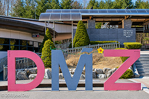
DMZ Exhibition Hall and Visitor Centre, Korean Demilitarized Zone (DMZ), Paju, South Korea (2013)
Woke up early to catch a bus to the DMZ and explore a few tourist-accessible areas. It was probably the coldest day I have experienced in a while, with the wind howling like it was. The good news is that the cold snap that came through overnight also cleared out the skies for excellent visibility.
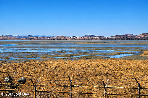
Barbed-Wire Security Fence Overlooking the Imjin River Estuary near the Korean Demilitarized Zone (DMZ), Paju, South Korea (2013)
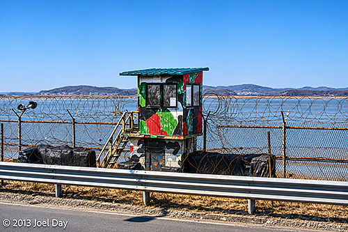
The DMZ is only about an hour’s drive north of Seoul, and as you get closer while driving up the coast, you can feel the seriousness of the area starting to build as razor wire fences begin to appear next to beaches, with military observation posts overlooking inlets that divide the North from the South.
Camouflaged Military Guard Post Along Highway 77, Overlooking the Han River Estuary near the Korean Demilitarized Zone (DMZ), South Korea (2013)
Bus Ride to the DMZ
Map of the route “The DMZ up close and personal”: 57,643 m, 53 m of climbing and 72 m of descent, time 00:50:36. It starts at 37.55292, 126.93351 and ends at 37.89072, 126.74202 (latitude, longitude).
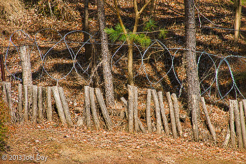
Barbed-Wire Security Fencing and Defensive Barriers near the Korean Demilitarized Zone (DMZ), Paju, South Korea (2013)
You are instructed to bring your passport and carry it with you at all times while on the tour. They write everyone’s passport number down for their records before they allow the tour bus in. Once inside, the tour bus weaves through tank barriers as it descends to the first stop, “The 3rd Tunnel”.
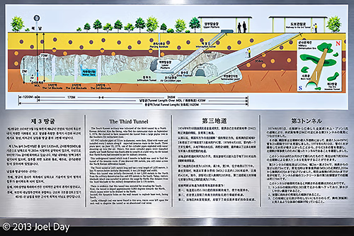
Diagram Explaining the Third Infiltration Tunnel beneath the Korean Demilitarized Zone (DMZ), South Korea (2013)
The 3rd Tunnel is a tunnel North Koreans dug under the DMZ, discovered in 1978. It is now a tourist attraction with a ramp and a train ride down to a depth of 73 meters below ground. We had the cheap tour that required us to walk all the way down and all the way back up, which was a decent workout. In the tunnel, which required hardhats and me to bend over as I walked the whole way, you can get within 170 meters of the actual demarcation line between the two countries, but there are 3 thick steel barriers installed thereafter to keep the North Koreans from using it to invade the south as they had originally planned.
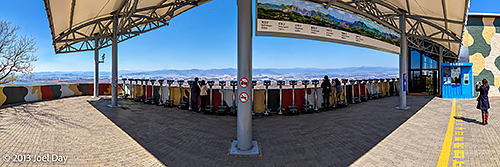
Viewing Platform and Observation Binoculars at Dora Observatory, Overlooking North Korea from the Demilitarized Zone (DMZ), South Korea (2013)
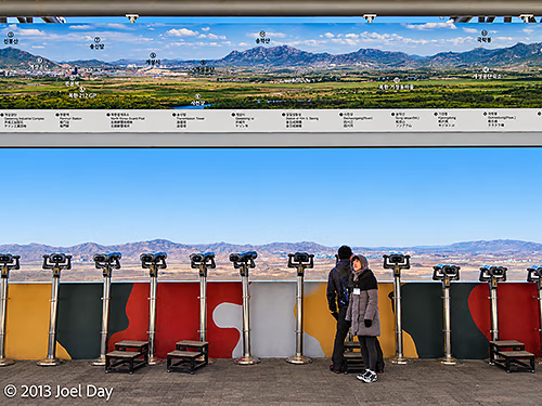
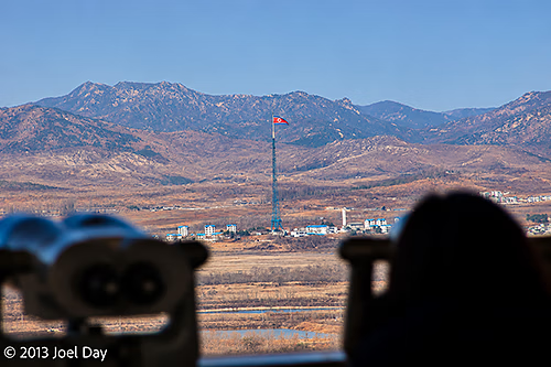
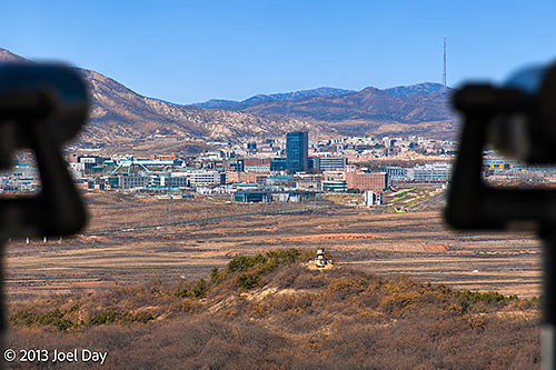
From there we climbed a big hill (in a comfortable tour bus) that overlooked the border where you could see North Korean cities and housing and scrutinise them with binoculars. I wasn’t allowed to take pictures closer than the yellow line you see in the preceding photo, and a South Korean military soldier watched me closely to ensure I complied the whole time I took the following three pictures.
Viewing Platform and Observation Binoculars at Dora Observatory, Overlooking North Korea from the Demilitarized Zone (DMZ), South Korea (2013)North Korean Flag Flying over Kijong-dong (Propaganda Village), Viewed from Dora Observatory in the Demilitarized Zone (DMZ), South Korea (2013)Kaesong Industrial Complex, North Korea, Viewed from the Dora Observatory in the Demilitarized Zone (DMZ), South Korea (2013)
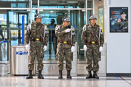
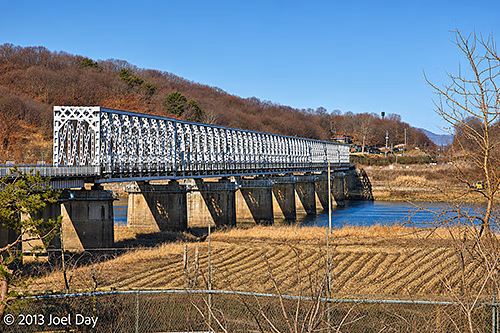
After that, we visited a brand-new train station that they hope will one day be a stop on the way into the north and beyond to China, Russia, and Europe.
South Korean Military Police Standing Guard at Dorasan Railway Station, Korean Demilitarized Zone (DMZ), South Korea (2013)Inter-Korean Railway Bridge near Dorasan, South Korea, on the Gyeongui Line to Kaesong, North Korea (2013)
Korean Demilitarised Zone Tour
Map of the route “The DMZ up close and personal”: 5,601 m, 124 m of climbing and 146 m of descent, elevation between 12 m and 143 m, time 00:34:05. It starts at 37.91645, 126.69859 and ends at 37.89935, 126.70954 (latitude, longitude).
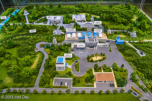
Unfortunately, much of the tour was heavily restricted photographically. It is also possible to get an even closer tour down to the actual border that lasts longer, but it is also much more expensive and requires security clearance several days in advance. I had to settle for this diorama instead…
Scale Model of the Joint Security Area (JSA) at Panmunjom, Korean Demilitarized Zone (DMZ), South Korea (2013)
After the DMZ tour, I rode the bus back into Seoul and hopped the subway to visit the National Museum of Korea – the biggest in the country. It’s interesting to see how South Korea doesn’t really see itself as a ‘South’ because so much of its ancient history is intertwined with the North. Aside from government offices, virtually every institution just refers to itself as ‘Korean’ as though it is patiently waiting for an inevitable reunification with their cousins to the north. The National Museum of Korea was full of ancient artefacts from across the Korean Peninsula that had been held for decades, and it made little effort to distinguish between the two.
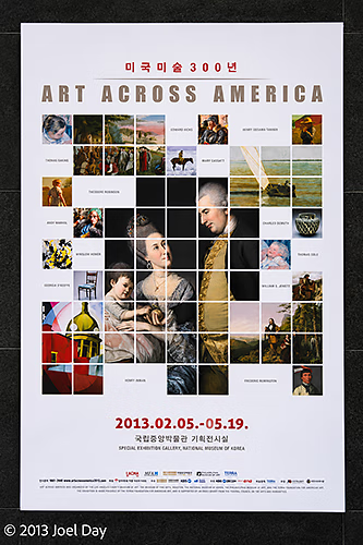
“Art Across America” Exhibition Poster Celebrating 300 Years of American Art, Seoul Arts Center, Seoul, South Korea (2013)
Most museums I visited in Seoul were free, which is always nice, but I noticed a special exhibition that required a fee. It sounded too interesting to pass up, so I coughed up some quid and headed on in. It was titled ‘Art Across America ‘, and I was amazed to see that a good quarter of the exhibit contained paintings and furniture from my hometown, the Philadelphia Museum of Art, including quite a few that I recognised. I also recognised other pieces from LACMA in Los Angeles, which I often visit while in California.
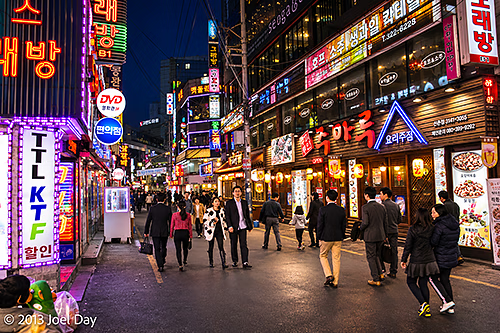
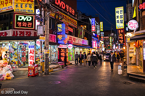
Bustling Nightlife Street Illuminated by Neon Signs and Korean Restaurants – Seoul, South Korea
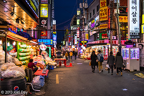
Well, two days into my South Korean visit and I’m quite impressed! It has a bit of a cold, dark, dank Tokyo feel, but that’s probably largely due to the season. It seems much easier to travel around Tokyo than in Tokyo because so many people at least seem to know some English. Those who speak fluent English haven’t been afraid to come out and help me when I’ve looked dazed or confused while trying to find my hotel or navigate the subway system.
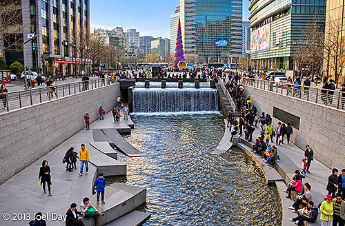
Cheonggyecheon Stream Waterfall and Cheonggye Plaza in Central Seoul – South Korea
My hotel room is TINY, but I knew that when I signed up. It’s only $50 a night, and it had rave TripAdvisor reviews, so I jumped on the deal. It has everything you need (private shower right over the toilet, big HD colour TV, teapot, fridge, bed). I’m very happy with the place, in hip Sinchon, full of funky shops, bars, and restaurants, and right on the excellent subway system. A bit of a university neighbourhood, which is always nice. The people who run it are very nice, speak fluent English, and are very good at offering suggestions on what to see and do.
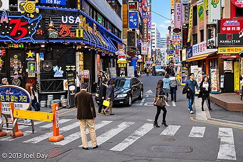
Colourful Neon Signs, Restaurants and Bars in Seoul’s Itaewon Entertainment District – South Korea
Seoul is very safe, and I’ve found most people very friendly and patient with a foreign-language speaker like myself. I always feel obligated to ask how safe the area is for me to walk around with a camera, and I often get laughed at like it was a stupid question because it IS so safe.
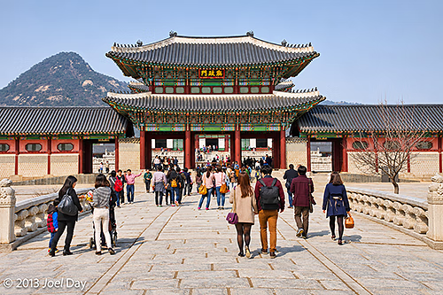
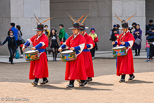
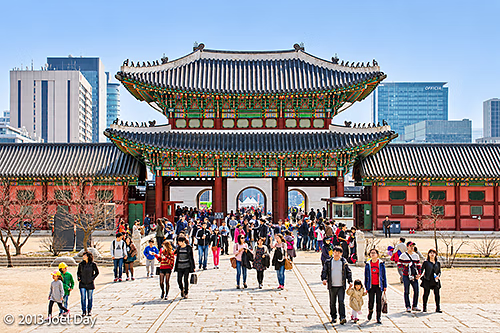
Heungnyemun Gate at Gyeongbokgung Palace, with Bugaksan Mountain in the Background – Seoul, South KoreaRoyal Guard Drummers During the Changing of the Guard Ceremony at Gyeongbokgung Palace – Seoul, South Korea
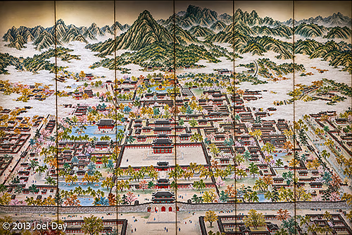
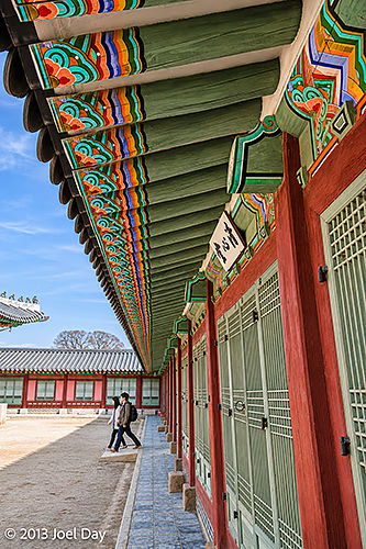
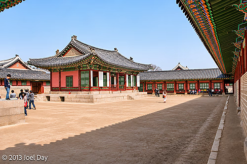
I headed out to Gyeongbokgung Palace to check it out, along with a few other things in the neighbourhood this afternoon. It’s an amazing, huge place that borders the South Korean President’s house in the back. Sadly, the Japanese destroyed the place TWICE over the years, burning it to the ground in 1592 and tearing down a previously restored version during WWII so they could plop their own HQ in its place. Now restored again, we’ll see how long it lasts this time!
Gyeongbokgung Palace Snoop
Map of the route “Funky Seoul”: 2,164 m, 22 m of climbing and 5 m of descent, elevation between 33 m and 58 m, time 01:11:02. It starts at 37.57655, 126.97555 and ends at 37.58135, 126.97818 (latitude, longitude).
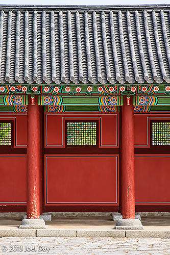
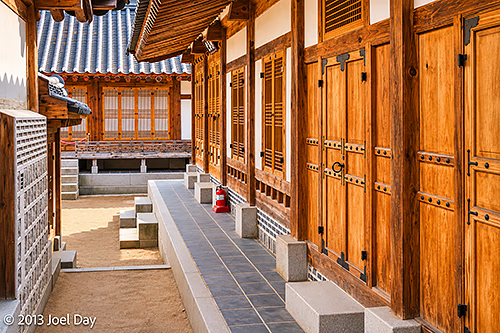
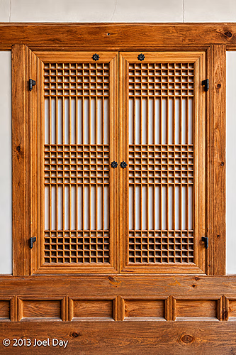
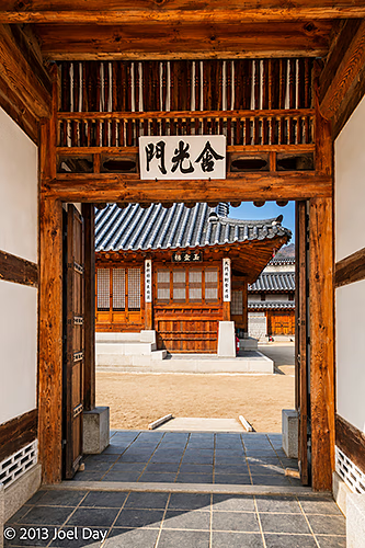
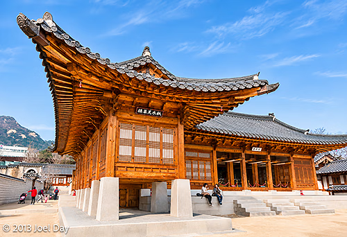
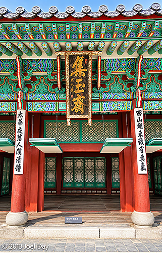
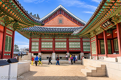
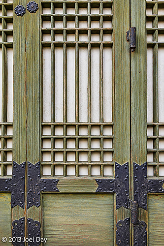
Traditional Folding Screen Depicting Gyeongbokgung Palace and the Surrounding Mountains – Seoul, South KoreaColourful Dancheong-Painted Eaves and Traditional Wooden Doors at Gyeongbokgung Palace – Seoul, South KoreaTraditional Royal Residential Buildings and Courtyard at Gyeongbokgung Palace – Seoul, South KoreaTraditional Joseon Dynasty Architecture and Colourful Dancheong Decorations at Gyeongbokgung Palace – Seoul, South KoreaTraditional Wooden Doors and Covered Walkway in the Jibokjae Royal Library Complex at Gyeongbokgung Palace – Seoul, South KoreaTraditional Wooden Lattice Window in the Jibokjae Royal Library Complex at Gyeongbokgung Palace – Seoul, South KoreaTraditional Wooden Buildings and Courtyard in the Jibokjae Royal Library Complex at Gyeongbokgung Palace – Seoul, South KoreaGeumgwangmun Gate Leading into the Jibokjae Royal Library Complex at Gyeongbokgung Palace – Seoul, South KoreaTraditional Wooden Architecture of Jibokjae Royal Library Complex at Gyeongbokgung Palace – Seoul, South KoreaOrnately Decorated Entrance to Jibokjae Hall at Gyeongbokgung Palace – Seoul, South KoreaTraditional Joseon Dynasty Palace Buildings Framing a Courtyard at Gyeongbokgung Palace – Seoul, South KoreaTraditional Wooden Lattice Doors with Decorative Iron Fittings at Gyeongbokgung Palace – Seoul, South KoreaHeungnyemun Gate at Gyeongbokgung Palace, Viewed from Inside the Palace Complex – Seoul, South Korea
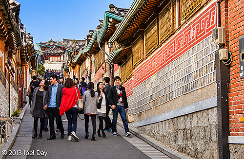
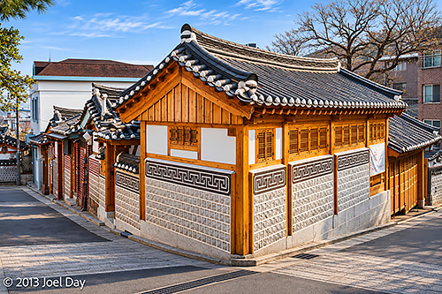
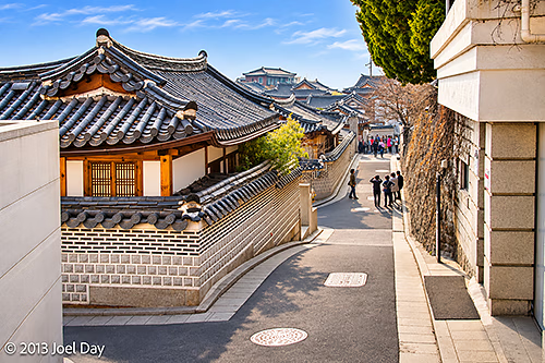
There were a few excellent free museums adjacent to the palace, one on the palace and another on Korean folk art. After leaving the palace, I strolled into a few busy historic neighbourhoods nearby, full of homes and shops preserved in traditional Korean architectural styles and owned by very wealthy people. And packed with many tourists!
Crowds of Tourists Walking Along a Narrow Street Lined with Traditional Hanok Houses in Bukchon Hanok Village – Seoul, South KoreaTraditional Hanok House at a Street Corner in Bukchon Hanok Village – Seoul, South KoreaNarrow Hillside Street Lined with Traditional Hanok Houses in Bukchon Hanok Village – Seoul, South Korea
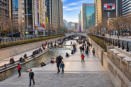
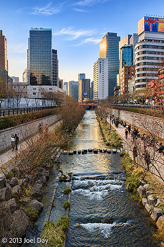
After that, I kept walking south into the centre of town through countless pedestrian malls closed to traffic, until I found a canal running alongside public walkways. Too bad they had a few too many foot-crossing stones permanently affixed – it would have made a great little whitewater paddling circuit!
Cheonggyecheon Stream and Pedestrian Walkways Surrounded by Modern Skyscrapers – Seoul, South KoreaCheonggyecheon Stream and Pedestrian Walkways Surrounded by Modern Skyscrapers – Seoul, South Korea
Seoul Snoop
Map of the route “Funky Seoul”: 4,883 m, 6 m of climbing and 36 m of descent, elevation between 15 m and 54 m, time 01:17:31. It starts at 37.58303, 126.98401 and ends at 37.56599, 126.97741 (latitude, longitude).
Or should I say, “I shall go to Korea if I can only get through China on the way!”
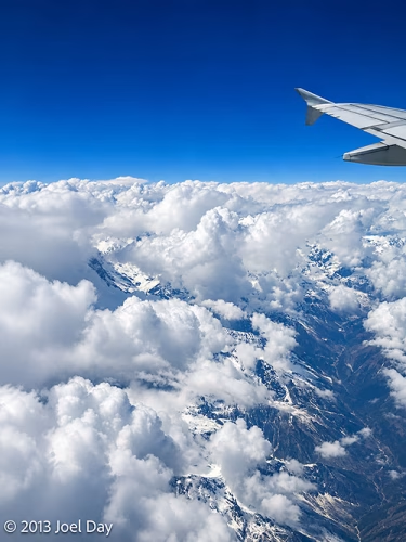
An eventful day, starting with another strike in Kathmandu that left the roads deserted of cars, but not people or rubble (placed there by protesters to hamper vehicular traffic). After our Air China flight finally took off, they announced in Mandarin that we were flying right past Mount Everest! Unfortunately, everyone on the right side of the plane got up and ran across the aisle to see it, which was a bit dicey. We were all disappointed because it stayed shrouded in clouds. Oh well. We continued on our way to Lhasa, Tibet.
Mount Everest hiding behind clouds
As we started our descent into Lhasa, they warned us about turbulence. Then the pilot suddenly announced in Mandarin that it was too dangerous to land due to a blizzard, so they’d skip it and fly straight to Chengdu. Many of the passengers began cheering, and I thought it was someone’s birthday, but then they translated it into English. Skipping a layover sounds nice, but it meant we arrived two hours early, and I was left with seven hours to kill without being allowed to go anywhere. I’m not sure how many on the plane were disadvantaged by the decision, but they stayed quiet.
Flight from Kathmandu, Nepal to Chengdu, China
Map of the route “I shall go to Korea.”: 2,004,319 m, 2,267 m of climbing and 2,972 m of descent, elevation between 572 m and 3,240 m, time 03:15:34. It starts at 27.69818, 85.35777 and ends at 30.56683, 103.94920 (latitude, longitude).
Once I arrived in Chengdu, I had to face immigration without a Chinese visa. They were actually very nice, but they confiscated my passport and told me I wasn’t allowed to leave the airport terminal. At one point, 5 Chinese officials escorted me around. I get the impression they don’t deal with too many transient visitors. Chengdu airport is huge, with many empty, unused gates. Even so, they forced our plane to park way out on the tarmac, with 90% of the gates empty, and bused us in. I managed to squeeze some Yuan out of an ATM so I could get some dinner after finally finding out how much it was worth, so I knew not to overdraw or underdraw my account.
When they confiscated my passport, I immediately asked how I would get it back (as I had never been asked to surrender it before). An official assured me that when it came time to check in for my midnight flight, the passport would be waiting at the check-in desk for me to pick up, and the flight staff would know about the whole situation.
Normally, you can’t check in in person until about 3 hours before your flight, so I wasted many an hour shuffling around the huge, empty terminal as it closed more and more shops in the evening. So I finally got my chance to check in, and I got to the check-in counter. Of course, the staff knew absolutely nothing about it. They also couldn’t check me in without a valid passport, so I was completely stuck. As it turns out, my passport was not at the check-in counter, but sitting in an immigration office about 300 meters away – behind a security zone, which required a passport and a boarding pass to get through, and next to the emigration queue that also requires the same plus a valid visa from the Chinese government.
Nobody at the check-in counter knew what to do about this conundrum until I quietly mentioned that I actually had two passports (which I never disclosed to the Chinese officials, but then again, they never asked). This got everyone excited because it offered a partial solution: I could get my boarding pass, which let me get through security and closer to the immigration office.
In the end, an airline official escorted me through security straight to the immigration office that held my other passport. They were able to get the managing Chinese official to come out, and he very nicely went to great lengths to expedite my acceleration through the final emigration line – even going so far as to actually fill in immigration forms for me so I could legally leave the country I was denied access to visiting in the first place. Now my passport has a Chinese emigration stamp even though I was never technically in the country.
I don’t know if I was their first ever transient passenger, but they obviously need to grease the wheels on their processes… But maybe it’s just the Chinese way of conducting business. Other countries usually offer a last-minute escape route for transients only there to catch connecting flights, which you usually find just before you reach the immigration desks. This keeps you in the emigration holding zone and lets you circumvent the issue, although I have heard Canadians complain about having to go through U.S. customs when trying to simply go south of the USA.
Everyone was always very nice, polite, and respectful in this episode, as you always are when dealing with government officials, and nobody ever suggested or even implied that I had ever done anything wrong, but… what a circus!
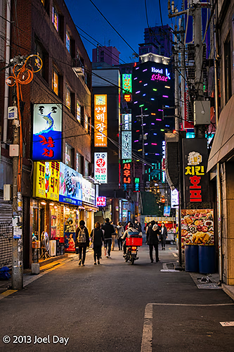
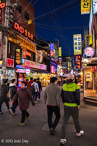
Fortunately, I made it to Seoul as scheduled and navigated the extensive train and subway network with my luggage to find my hotel.
Bustling Nightlife Street Illuminated by Neon Signs and Korean Restaurants – Seoul, South KoreaNeon-Lit Restaurants and Narrow Streets in Seoul’s Nightlife District – South KoreaBustling Nightlife Street Illuminated by Neon Signs and Korean Restaurants – Seoul, South KoreaBustling Nightlife Street Illuminated by Neon Signs and Korean Restaurants – Seoul, South Korea
Flight from Chengdu, China to Seoul, South Korea
Map of the route “I shall go to Korea.”: 2,488,330 m, 2,185 m of climbing and 2,177 m of descent, elevation between 445 m and 2,426 m, time 03:30:01. It starts at 30.58538, 103.95466 and ends at 37.44687, 126.44552 (latitude, longitude).
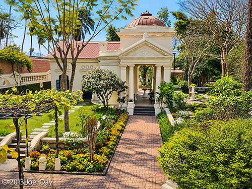
Neoclassical Pavilion and Formal Landscaped Gardens at the Garden of Dreams (Kaiser Mahal), Kathmandu, Nepal
It’s my last day in Nepal, so I decided to explore a street I’ve driven down many times that has the old palace, now a museum. Unfortunately, the museum is closed, so I pony up my two bits to see the famous “Garden of Dreams” next door instead. It’s an odd intersection because a large compound across the street is protected by U.S. military officers, but it isn’t the embassy. Instead, I discover later, it’s an “American club” for diplomatic staff and expats – no tourists allowed. Sort of a country club with a baseball field, pool, etc. I remember seeing something similar in Colombo, but I’d never heard of it in Australia.
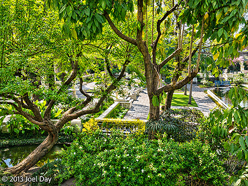
Lush Tropical Vegetation, Ornamental Trees and Formal Garden Pathways at the Garden of Dreams, Kathmandu, Nepal
Anyway, the Garden of Dreams was quite nice. It is an old garden that had fallen into disrepair prior to 2006, when it was fixed up and restored to its original splendour. It is located behind a big wall, protected from the noisy, dirty, busy street that runs between the old palace and the American club. There were a number of restaurants and cafes inside, so I decided to kick back with a cup of coffee to enjoy the surroundings a little longer. A little bit of paradise inside big, noisy, dirty Kathmandu.
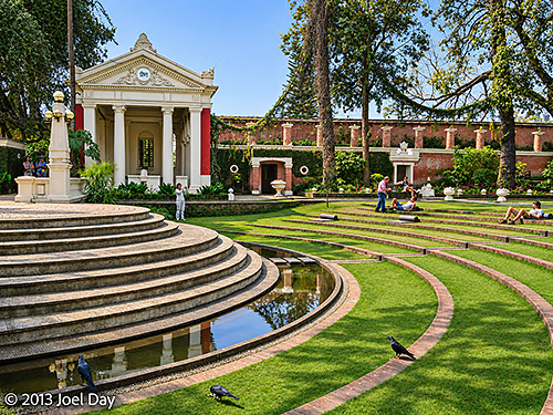
Neoclassical Pavilion, Semicircular Amphitheatre and Ornamental Reflecting Pool at the Garden of Dreams (Kaiser Mahal), Kathmandu, Nepal
When I left the gardens, it suddenly struck me that there were no cars around and all the stores were still closed. Another strike? You bet! Another strike to bookend my Nepalese experience. One strike the day after I first arrived, and another strike the day before I left. There were police with machine guns on the street corners of Thamel, my neighbourhood, so I thought it best to retreat to my hotel room since everything was closed and the streets were looking a bit edgy.
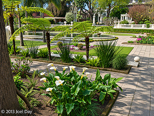
White Calla Lilies (Zantedeschia aethiopica) in the Formal Gardens of the Garden of Dreams, Kathmandu, Nepal
Fortunately, by evening, I found quite a few stores open where I could buy some last-minute souvenirs. Nepal has been lots of fun, but it does have a lot of problems, and I am looking forward to moving on tomorrow!
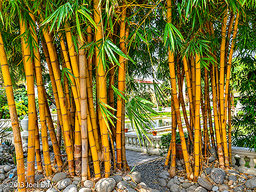
Golden Bamboo Grove (Bambusa sp.) at the Garden of Dreams (Kaiser Mahal), Kathmandu, Nepal
Today’s newspaper reported that Nepal ranks #8 on the misery index. That is, Nepal is considered the 8th most miserable place to live, just below Syria and Kosovo but above Namibia, Djibouti, Turkmenistan, Belarus, Burkina Faso, Liberia, and Zimbabwe. That must have something to do with persistent power outages, air pollution, noise pollution, crumbling infrastructure, and a lack of employment opportunities. Nepal plans to invest in a range of infrastructure improvements over the next ten years now that the political situation has begun to stabilise somewhat.
I hopped on a Yeti flight today (yes, they even have an airline named after the Abominable Snowman). It took me back to Kathmandu from Pokhara for the last few nights before I flew out. I was instructed to make sure I had a seat on the left side of the plane so I could admire all the Himalayan peaks as we made our 25-minute journey. I didn’t think it would make much difference with all the haze and smog that has accumulated since my hike, but we punched through most of the diffusion in our simple prop plane so I could see all the peaks along the way. And yes, they were pretty cool to watch as we flew past.
Yeti Flight from Pokhara to Kathmandu, Nepal
Map of the route “The News from Nepal”: 216,595 m, 767 m of climbing and 215 m of descent, elevation between 658 m and 1,321 m, time 00:49:20. It starts at 28.19883, 83.97833 and ends at 27.70224, 85.36009 (latitude, longitude).
Now back in Kathmandu, I ventured out for a haircut while the offering was cheap. Like many things around here (including taxis), there always seem to be strings attached to any quoted price. One bizarre custom among hair cutters in Nepal is that they also provide all kinds of massage services. This has put me off many times, but I did stumble across a place where two Westerners were already getting haircuts, so I thought I would get mine done. I tried to find out the price before we started, but all I got was “As you wish”. Finally, after I got him to mention 200 ringgit (just over $2), he started in and pulled out the exact same clippers I use to cut my own hair. After finishing with the cut, he started slipping in little additional services that were related, like shaving the back of my neck and behind my ears with a straight razor. Then he starts mumbling about putting ointment in my hair, and he starts his head massage. Then, before you know it, he tries to work his way down to a back massage, and I had to cut him off since the haircut was already finished. The whole thing was totally bizarre.
On my last full day in Pokhara, thick haze returned and blocked most views of the Himalayas, so I decided to check out the International Mountain Museum. Getting there became the usual drama in places like this. All you want is a simple taxi ride to the museum, and everyone’s eyes light up like it’s a potential sales opportunity for a day-long chauffeur job. It makes you think twice before going anywhere that requires a cab!
None of the cab drivers around here wants to use their meters, so you need to negotiate a price before you get in. Then, on the way there, they try to entice you to see all the sights around town you haven’t been to yet. Then they insist on a round-trip fare and say they will wait for you while you see the museum. “Half hour?” they ask. “Um, actually, how about 2 hours. I like to take my time.” I read the museum was quite large. They look at you like you’re crazy, and I’m sure the financial appeal of the deal suddenly doesn’t sound so good. I send him off, telling him to come back in 2 hours and not wait so he has the opportunity to earn from others, but I’m not sure he ever left.
Anyway, the museum was quite interesting, and it took me a few hours to get through it. There was information on each of the world’s 20 highest peaks (even more interesting after hiking past some of them) and who first climbed them. There was information on all the local plants and animals of Nepal, as well as the Yeti(!) The museum also had gear donated that had been used to reach some of the summits. It was interesting to see how rudimentary some of it was by today’s standards. Most of the gear seemed to have been donated by Asian expeditions, not from the West. There were also displays on each of the native groups prominent in different regions of the country, like the Sherpas of the Everest area.
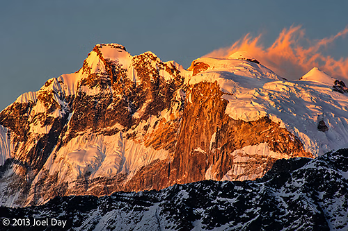
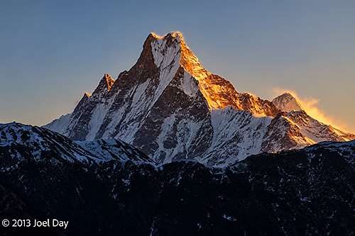
It seemed as though the 1950’s were the big years to conquer all the summits. One peak in Nepal has still never been successfully climbed, but the Nepalese government stopped allowing attempts in 1963. It’s called Machapuchare (also known as Fishtail Mountain, named for its twin peaks that look like a fishtail), with an elevation of 6,993 meters. It is very steep and difficult to ascend.
Sunrise illuminating the distinctive twin summit of Machapuchare (Fishtail Mountain, 6,993 m), viewed from Poon Hill (3,210 m), Gandaki Province, Nepal
One of the most interesting displays was of all the garbage they have cleaned up from Mount Everest. One climber who eventually made it to the top was so dismayed by all the things left by previous climbers that he organised a regular cleaning campaign to collect the waste and fly it out. Among the debris were pieces of broken ladders (used to get across crevices in the ice), big piles of cooking stove gas canisters (some flattened by ice pressure over time), old ripped-up tent fragments, and big piles of oxygen tanks – some dating back to the 1960s.
The Nepalese have a custom they use when they hand you money, food, or menus. They extend the item with their right hand while showing respect with their left by touching their right elbow. It’s actually quite classy, I think.
Otherwise, I always find it interesting when political borders don’t really match the cultural borders in most countries. There always seem to be transitions taking place from region to region. Nepal is predominantly Hindu, but the majority of people living in the mountains are Buddhist – which is closest to Tibet/China. Some of the traditional Nepalese music you hear sounds either very Chinese or very Indian to me. Many of the TV shows you see look like Indian shows. Every time I attributed a cultural element I encountered to another country, my trekking guide quickly corrected me and said it was Nepalese. The traditional dress worn by both women and men here also looks similar to what people wear in other mountain regions northwest of Nepal.
With just a few days left in Pokhara, I’ve taken a day to rest and recover from endless Annapurna stair climbs and descents, and I’ve lined up some mountain biking in the nearby hills this morning. As with all my other pursuits here, I’ve found a personal guide to show me around. Or at least I did initially. An Australian guy from Victoria came and joined us at the last minute. It certainly seems a bit slow here this time of year, but that is good for me. Nepal seemed pretty busy with Chinese tourists when I first arrived, but that was because of the Chinese New Year holiday period in China, which is over now.
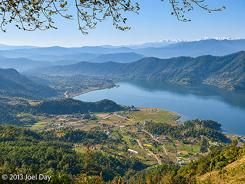
Hazy view of Phewa Lake from one of the peaks of our mountain biking journey with Pokhara and the Himalayan Mountains in the background
Hills? More like mountains! The mountain bike circuit, which was supposed to be their least hilly option, kicked off with a 500-meter climb up to the top of a ridge overlooking the city of Pokhara and its neighbouring lake. Too bad the place has become so hazy again – the views would have been quite spectacular otherwise. From the top, it ran along a gentle, roller-coaster, ridge-hugging track for a while before a quick descent to a huge plateau of rice paddies next to the lake. From there, the ride was fairly flat all the way back into town. About 700 meters of climbing in all and 30 km in length. Our guide offered to take us up another mountain on the other side of the lake, but we both politely declined.
Pokhara Mountain Biking Circuit
Map of the route “Pokhara MTB”: 27,838 m, 609 m of climbing and 617 m of descent, elevation between 807 m and 1,320 m, time 03:01:27. It is a loop that starts and ends at 28.21401, 83.95783 (latitude, longitude).
I don’t know why, but every time I’ve rented a bike overseas, the seat post has kept sliding down until the bike became too hard to pedal, and I had to stop and raise it again. This has happened to me in Fiji, Egypt, and now Nepal. Otherwise, it was a much nicer bike than I have been able to rent in the past.
The bike tour operator was actually a front for a local mountain bike club. Good mountain bikes are prohibitively expensive for many Nepalese, so the club ran tours for tourists and charged fees high enough to buy good bikes for club members, who would ride them the rest of the time.
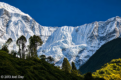
Snow-covered peaks and dramatic glacial slopes of the Annapurna massif, viewed along the trekking route between Jhinu Danda and Birethanti, Annapurna Conservation Area, Nepal
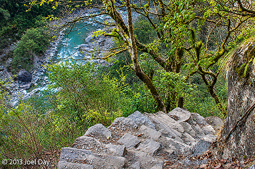
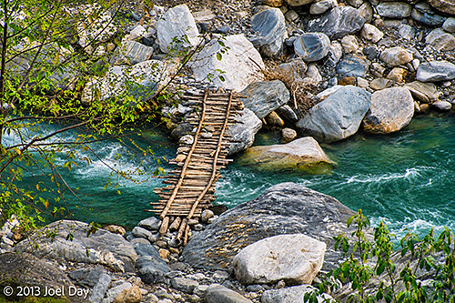
The final day of my Annapurna Trek was pretty straightforward. Up early for breakfast, down another steep staircase to the river to cross a bridge, back up the other side, rinse, and repeat.
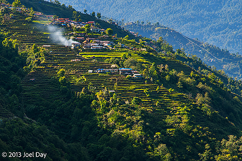
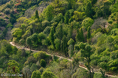
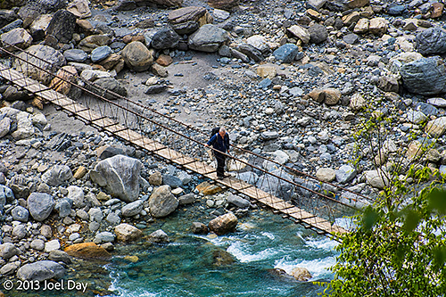
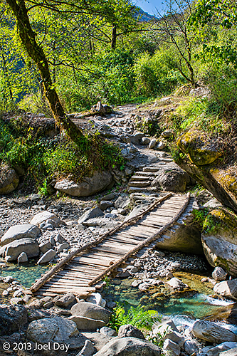
Traditional Nepalese hillside village surrounded by extensive terraced agricultural fields, illuminated by afternoon sunlight along the trekking route between Jhinu Danda and Birethanti, Annapurna Conservation Area, NepalSteep stone steps descending through lush Himalayan forest towards a turquoise mountain river, along the trekking route between Jhinu Danda and Birethanti, Annapurna Conservation Area, NepalTraditional wooden footbridge spanning a fast-flowing turquoise mountain stream, surrounded by large river boulders, along the trekking route between Jhinu Danda and Birethanti, Annapurna Conservation Area, NepalMountain trekking trail winding through lush subtropical forest on the steep Himalayan hillsides between Jhinu Danda and Birethanti, Annapurna Conservation Area, NepalLocal pedestrian crossing a narrow suspension footbridge over a fast-flowing, boulder-strewn mountain river, along the trekking route between Jhinu Danda and Birethanti, Annapurna Conservation Area, Nepal
Eventually our track widened to a roadway where a half dozen 4wd vehicles hung around waiting for tired hikers to ferry out. We passed them and continued as the road gradually became one long decline back along the river to where we started 5 days ago.
Day 5 Hike of the Annapurna Circuit
Map of the route “Annapurna Trek Day 5: The Finish Line”: 20,178 m, 359 m of climbing and 953 m of descent, elevation between 1,105 m and 1,707 m, time 05:50:35. It starts at 28.41023, 83.82436 and ends at 28.30957, 83.77464 (latitude, longitude).
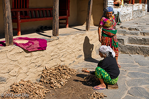
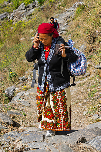
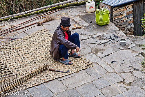
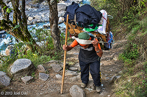
Overall, quite a spectacular hike. It was also very interesting to pass through all the villages and see how many Nepalese earn their keep.
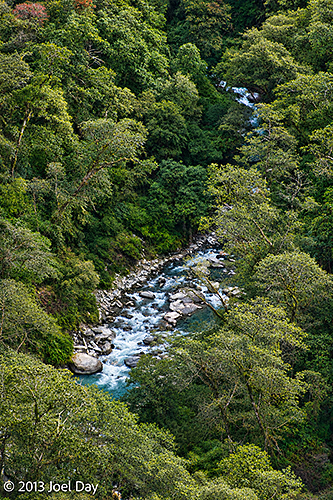
Two Nepalese women in colourful traditional clothing sorting and drying freshly harvested ginger outside a village house, along the trekking route between Jhinu Danda and Birethanti, Annapurna Conservation Area, NepalLocal Nepalese woman wearing colourful traditional clothing and carrying a large bundle along a steep stone trekking path while talking on mobile phone between Jhinu Danda and Birethanti, Annapurna Conservation Area, NepalLocal Nepalese craftsman weaving a traditional bamboo mat by hand in a stone-paved village courtyard, along the trekking route between Jhinu Danda and Birethanti, Annapurna Conservation Area, NepalTraditional wooden footbridge spanning a fast-flowing turquoise mountain stream, surrounded by large river boulders, along the trekking route between Jhinu Danda and Birethanti, Annapurna Conservation Area, NepalLocal Nepalese porter carrying a heavily laden traditional wicker basket (doko), supported by a forehead strap (namlo), along a steep, rocky mountain trail between Jhinu Danda and Birethanti, Annapurna Conservation Area, NepalMountain stream cascading through a densely forested valley in the Himalayan foothills, along the trekking route between Jhinu Danda and Birethanti, Annapurna Conservation Area, Nepal
One bit of irony: passing through countless villages that rely on spring water to drink and mules for deliveries, they always had power 24 hours a day, 7 days a week. Here in Pokhara, I’ve been back now for six hours and still have no power. It seems to be off more than it’s on. How do the villages get power?
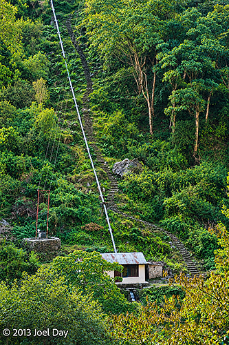
Small hydroelectric power station, possibly a micro-hydropower installation, with a steeply descending penstock on a forested hillside between Jhinu Danda and Birethanti, Annapurna Conservation Area, Nepal
They generate their own electricity through micro-hydroelectric generators that use channelled water from nearby streams. We passed quite a few of them. Each required substantial work to set up and could power only about 40 homes, but they’re lucky to have power when they need it.
Now back in Pokhara, in my choice room with spectacular views, my legs are very sore and sick of stairs! I do have a bathtub which I should put to use.
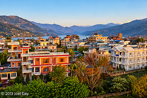
Early morning view across Pokhara, Nepal, showing colourful residential buildings, lush green gardens and surrounding forested hills, with the snow-capped Annapurna Himalaya visible in the distance
Full 5 Day Ghorepani & Poon Hill Annapurna Circuit Hike
Map of the route “Annapurna Trek Day 5: The Finish Line”: 88,324 m, 3,640 m of climbing and 3,585 m of descent, elevation between 1,026 m and 3,102 m, time 99:20:13. It starts at 28.29621, 83.76791 and ends at 28.30957, 83.77464 (latitude, longitude).
You must be logged in to post a comment.