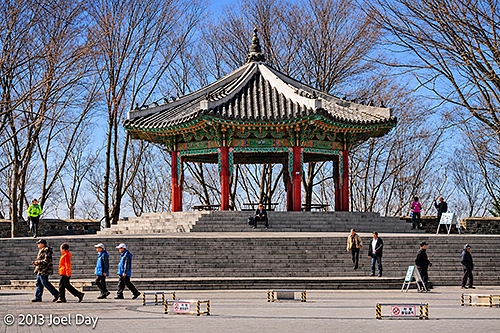
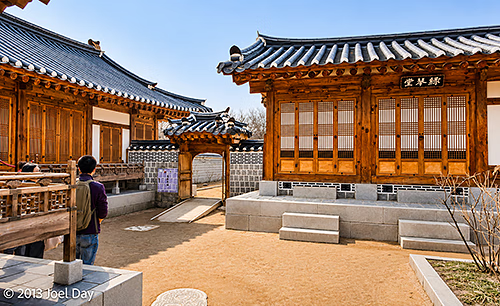
Traditional Korean Pavilion on Namsan Mountain, Near N Seoul Tower, Seoul, South Korea (2013)
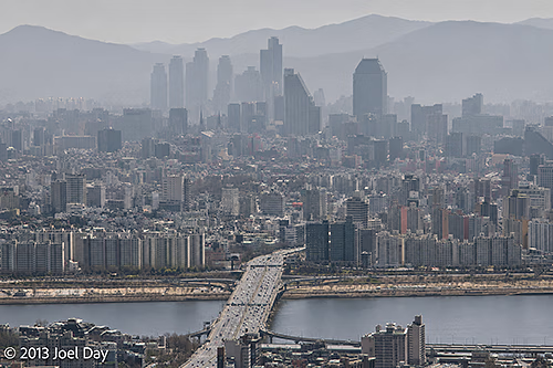
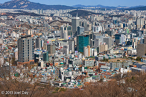
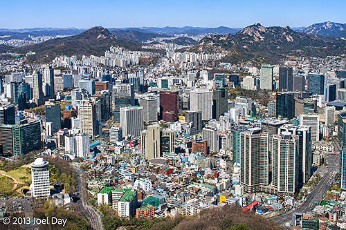
On my final day in Seoul, I sort of hit the skids. I had a lot I wanted to see, but unfortunately, since it was a Monday, most museums and palaces were closed. So I aimed for the tackiest of tourist attractions: The Space Needle – or N Seoul Tower – as the Koreans call it. It is positioned at the dead geographic centre of Seoul and is definitely geared towards young romantic couples. You could buy expensive restaurant packages for use on special floors at the top, plus a juvenile elevator ride with special space-effects video to watch on the ceiling. Plus the usual pictures to take: On arrival at the top, as a memento of the occasion (for $ of course). The view was quite extensive, although it was a bit hazy again. Seoul is a very big city of ~12,000,000 people, so it’s amazing to see it sprawled out everywhere, with mountains on the fringes and a river running through the middle.
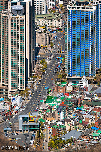
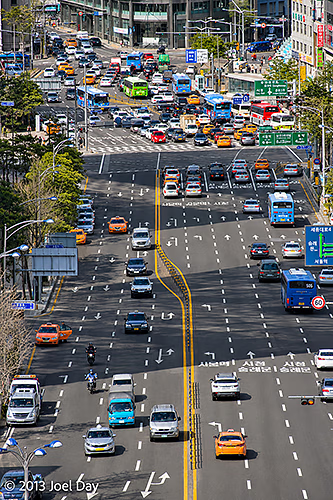
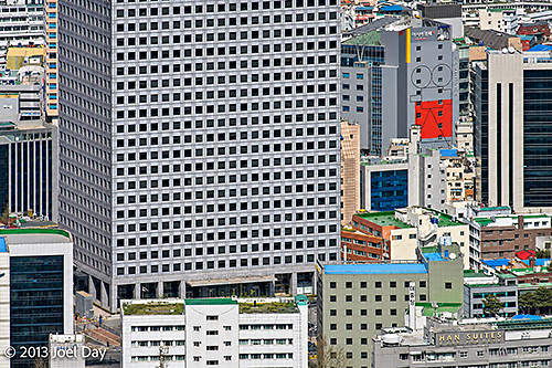
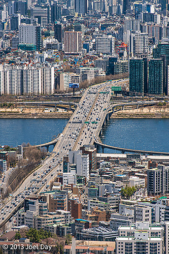
View of the Han River, Dongjak Bridge and Seoul’s Hazy Skyline from N Seoul Tower, South Korea (2013)View of the Lotte Hotel Seoul and Surrounding Streets in Myeongdong, from N Seoul Tower, South Korea (2013)Panoramic View of Central Seoul and the Surrounding Mountains from Namsan Mountain, South Korea (2013)Heavy Traffic at a Major Multi-Lane Intersection in Central Seoul, South Korea (2013)High-Rise Office Buildings and Dense Urban Development in Central Seoul, Viewed from Namsan Mountain, South Korea (2013)Dongjak Bridge (Dongjakdaegyo) Crossing the Han River, Viewed from N Seoul Tower, Seoul, South Korea (2013)Panoramic View of Downtown Seoul and the Surrounding Mountains from N Seoul Tower, South Korea (2013)
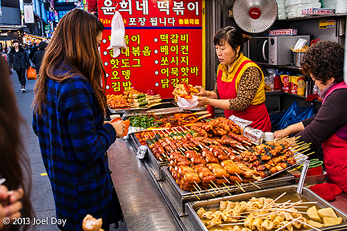
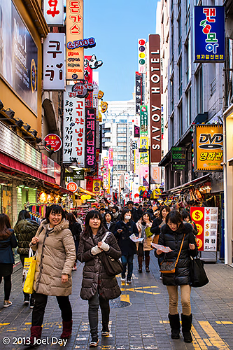
The ride to the top and bottom included a cable car that dropped you off at the bottom in an interesting neighbourhood of pedestrian shopping alleys that seemed to extend indefinitely around the city, full of little shops, restaurants, and food stalls. Maybe all of Seoul is like that. It is very nice. The variety and number of places to eat are amazing. And there are plenty of cafes to give Starbucks plenty of competition.
Street Food Stall Selling Grilled Skewers and Traditional Korean Snacks, Seoul, South Korea (2013)Busy Pedestrian Shopping Street in Myeongdong, Seoul, South Korea (2013)
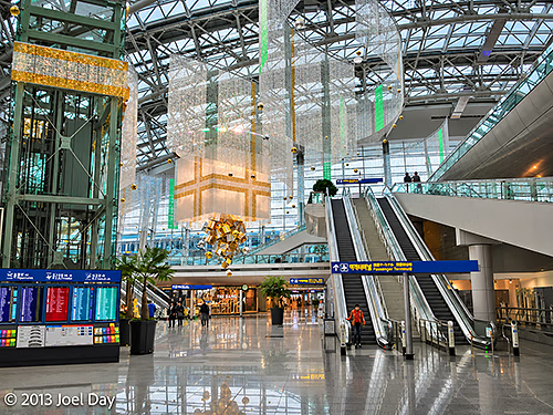
Now at the airport awaiting my flight to San Francisco, I have been very impressed with Korea and would like to come back to check out more. Very nice people, great food of every kind, excellent, slick public transportation network, world’s best airport for eight years running (or so they are claiming – it is very nice), including a great express train into the centre of town, and super-fast wifi everywhere you go (sometimes free, like everywhere here in the airport or at cafes, restaurants, museums, and hotels, or sometimes cheap at about $3 a day for access throughout the city, including the entire subway and train system). There also seems to be plenty of mountain biking, hiking, and probably paddling outside the city, as well as road biking throughout the city.
Exploring Seoul
Map of the route “On the Seoul Train”: 3,749 m, 24 m of climbing and 31 m of descent, elevation between 37 m and 55 m, time 00:51:20. It starts at 37.56078, 126.98175 and ends at 37.56802, 126.99847 (latitude, longitude).
The only downside has been the weather, which is comparable to the northeastern U.S. for this time of year: a bit colder and darker than I’m used to coming from sunny Australia.
Main Terminal Interior, Incheon International Airport, Seoul, South Korea (2013)
Flight from Seoul, South Korea to San Francisco, California
Map of the route “On the Seoul Train”: 9,703,022 m, 3,540 m of climbing and 3,158 m of descent, elevation between -40 m and 2,388 m, time 11:01:18. It starts at 37.45419, 126.44328 and ends at 37.61720, -122.39286 (latitude, longitude).
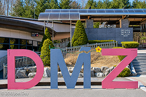
DMZ Exhibition Hall and Visitor Centre, Korean Demilitarized Zone (DMZ), Paju, South Korea (2013)
Woke up early to catch a bus to the DMZ and explore a few tourist-accessible areas. It was probably the coldest day I have experienced in a while, with the wind howling like it was. The good news is that the cold snap that came through overnight also cleared out the skies for excellent visibility.
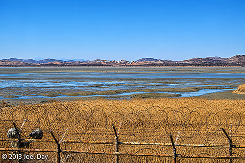
Barbed-Wire Security Fence Overlooking the Imjin River Estuary near the Korean Demilitarized Zone (DMZ), Paju, South Korea (2013)
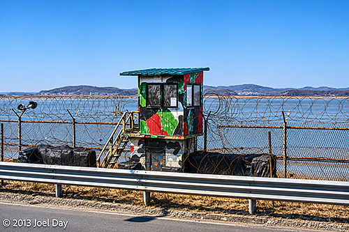
The DMZ is only about an hour’s drive north of Seoul, and as you get closer while driving up the coast, you can feel the seriousness of the area starting to build as razor wire fences begin to appear next to beaches, with military observation posts overlooking inlets that divide the North from the South.
Camouflaged Military Guard Post Along Highway 77, Overlooking the Han River Estuary near the Korean Demilitarized Zone (DMZ), South Korea (2013)
Bus Ride to the DMZ
Map of the route “The DMZ up close and personal”: 57,643 m, 112 m of climbing and 117 m of descent, time 00:50:36. It starts at 37.55292, 126.93351 and ends at 37.89072, 126.74202 (latitude, longitude).
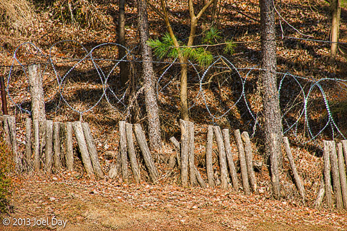
Barbed-Wire Security Fencing and Defensive Barriers near the Korean Demilitarized Zone (DMZ), Paju, South Korea (2013)
You are instructed to bring your passport and carry it with you at all times while on the tour. They write everyone’s passport number down for their records before they allow the tour bus in. Once inside, the tour bus weaves through tank barriers as it descends to the first stop, “The 3rd Tunnel”.
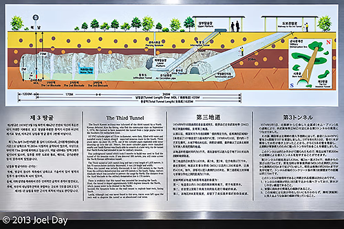
Diagram Explaining the Third Infiltration Tunnel beneath the Korean Demilitarized Zone (DMZ), South Korea (2013)
The 3rd Tunnel is a tunnel North Koreans dug under the DMZ, discovered in 1978. It is now a tourist attraction with a ramp and a train ride down to a depth of 73 meters below ground. We had the cheap tour that required us to walk all the way down and all the way back up, which was a decent workout. In the tunnel, which required hardhats and me to bend over as I walked the whole way, you can get within 170 meters of the actual demarcation line between the two countries, but there are 3 thick steel barriers installed thereafter to keep the North Koreans from using it to invade the south as they had originally planned.
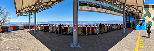
Viewing Platform and Observation Binoculars at Dora Observatory, Overlooking North Korea from the Demilitarized Zone (DMZ), South Korea (2013)
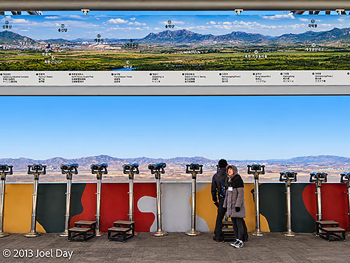
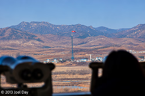
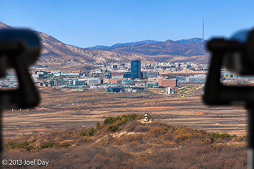
From there we climbed a big hill (in a comfortable tour bus) that overlooked the border where you could see North Korean cities and housing and scrutinise them with binoculars. I wasn’t allowed to take pictures closer than the yellow line you see in the preceding photo, and a South Korean military soldier watched me closely to ensure I complied the whole time I took the following three pictures.
Viewing Platform and Observation Binoculars at Dora Observatory, Overlooking North Korea from the Demilitarized Zone (DMZ), South Korea (2013)North Korean Flag Flying over Kijong-dong (Propaganda Village), Viewed from Dora Observatory in the Demilitarized Zone (DMZ), South Korea (2013)Kaesong Industrial Complex, North Korea, Viewed from the Dora Observatory in the Demilitarized Zone (DMZ), South Korea (2013)
After that, we visited a brand-new train station that they hope will one day be a stop on the way into the north and beyond to China, Russia, and Europe.
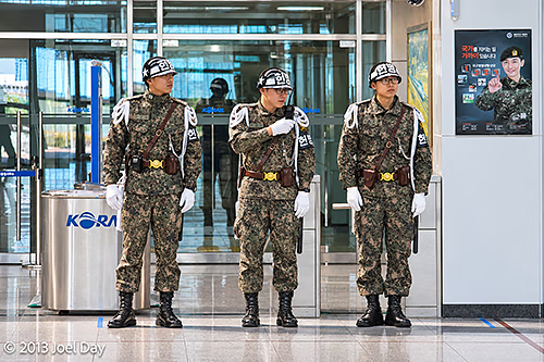
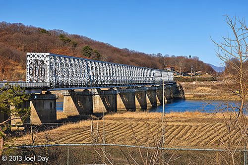
South Korean Military Police Standing Guard at Dorasan Railway Station, Korean Demilitarized Zone (DMZ), South Korea (2013)Inter-Korean Railway Bridge near Dorasan, South Korea, on the Gyeongui Line to Kaesong, North Korea (2013)
Korean Demilitarised Zone Tour
Map of the route “The DMZ up close and personal”: 5,601 m, 151 m of climbing and 174 m of descent, elevation between 12 m and 143 m, time 00:34:05. It starts at 37.91645, 126.69859 and ends at 37.89935, 126.70954 (latitude, longitude).
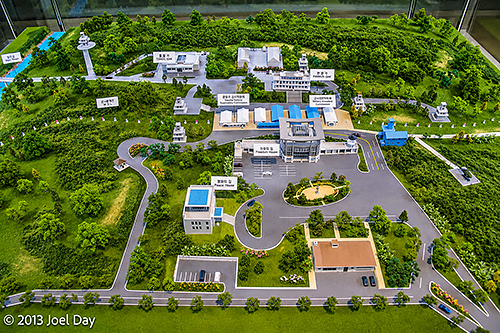
Unfortunately, much of the tour was heavily restricted photographically. It is also possible to get an even closer tour down to the actual border that lasts longer, but it is also much more expensive and requires security clearance several days in advance. I had to settle for this diorama instead…
Scale Model of the Joint Security Area (JSA) at Panmunjom, Korean Demilitarized Zone (DMZ), South Korea (2013)
After the DMZ tour, I rode the bus back into Seoul and hopped the subway to visit the National Museum of Korea – the biggest in the country. It’s interesting to see how South Korea doesn’t really see itself as a ‘South’ because so much of its ancient history is intertwined with the North. Aside from government offices, virtually every institution just refers to itself as ‘Korean’ as though it is patiently waiting for an inevitable reunification with their cousins to the north. The National Museum of Korea was full of ancient artefacts from across the Korean Peninsula that had been held for decades, and it made little effort to distinguish between the two.
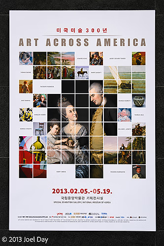
“Art Across America” Exhibition Poster Celebrating 300 Years of American Art, Seoul Arts Center, Seoul, South Korea (2013)
Most museums I visited in Seoul were free, which is always nice, but I noticed a special exhibition that required a fee. It sounded too interesting to pass up, so I coughed up some quid and headed on in. It was titled ‘Art Across America ‘, and I was amazed to see that a good quarter of the exhibit contained paintings and furniture from my hometown, the Philadelphia Museum of Art, including quite a few that I recognised. I also recognised other pieces from LACMA in Los Angeles, which I often visit while in California.
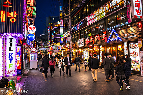
Bustling Nightlife Street Illuminated by Neon Signs and Korean Restaurants – Seoul, South Korea
Well, two days into my South Korean visit and I’m quite impressed! It has a bit of a cold, dark, dank Tokyo feel, but that’s probably largely due to the season. It seems much easier to travel around Tokyo than in Tokyo because so many people at least seem to know some English. Those who speak fluent English haven’t been afraid to come out and help me when I’ve looked dazed or confused while trying to find my hotel or navigate the subway system.
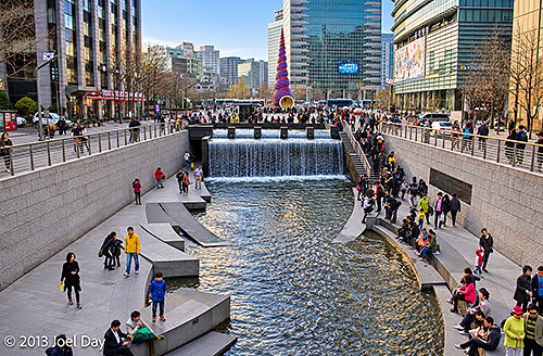
Cheonggyecheon Stream Waterfall and Cheonggye Plaza in Central Seoul – South Korea
My hotel room is TINY, but I knew that when I signed up. It’s only $50 a night, and it had rave TripAdvisor reviews, so I jumped on the deal. It has everything you need (private shower right over the toilet, big HD colour TV, teapot, fridge, bed). I’m very happy with the place, in hip Sinchon, full of funky shops, bars, and restaurants, and right on the excellent subway system. A bit of a university neighbourhood, which is always nice. The people who run it are very nice, speak fluent English, and are very good at offering suggestions on what to see and do.
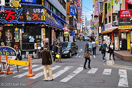
Colourful Neon Signs, Restaurants and Bars in Seoul’s Itaewon Entertainment District – South Korea
Seoul is very safe, and I’ve found most people very friendly and patient with a foreign-language speaker like myself. I always feel obligated to ask how safe the area is for me to walk around with a camera, and I often get laughed at like it was a stupid question because it IS so safe.
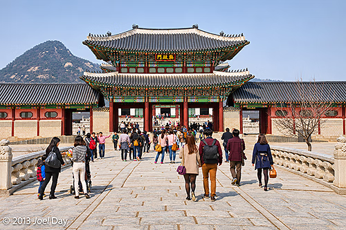
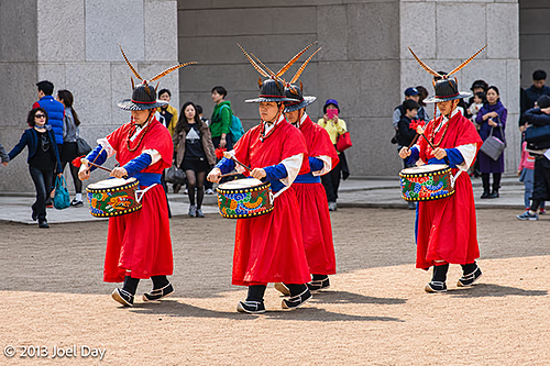
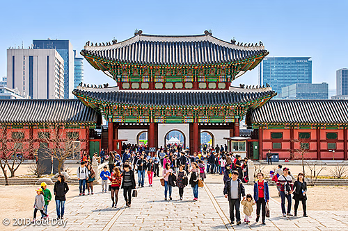
Heungnyemun Gate at Gyeongbokgung Palace, with Bugaksan Mountain in the Background – Seoul, South KoreaRoyal Guard Drummers During the Changing of the Guard Ceremony at Gyeongbokgung Palace – Seoul, South Korea
I headed out to Gyeongbokgung Palace to check it out, along with a few other things in the neighbourhood this afternoon. It’s an amazing, huge place that borders the South Korean President’s house in the back. Sadly, the Japanese destroyed the place TWICE over the years, burning it to the ground in 1592 and tearing down a previously restored version during WWII so they could plop their own HQ in its place. Now restored again, we’ll see how long it lasts this time!
Gyeongbokgung Palace Snoop
Map of the route “Funky Seoul”: 2,164 m, 62 m of climbing and 46 m of descent, elevation between 33 m and 58 m, time 01:11:02. It starts at 37.57655, 126.97555 and ends at 37.58135, 126.97818 (latitude, longitude).
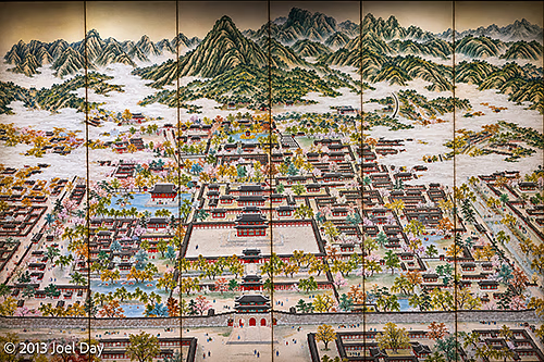
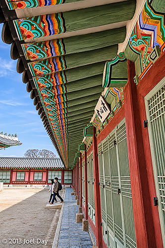
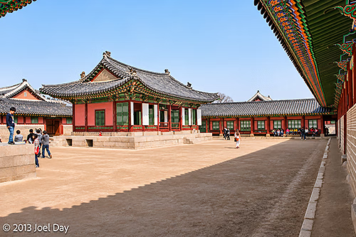
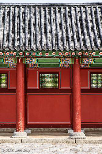
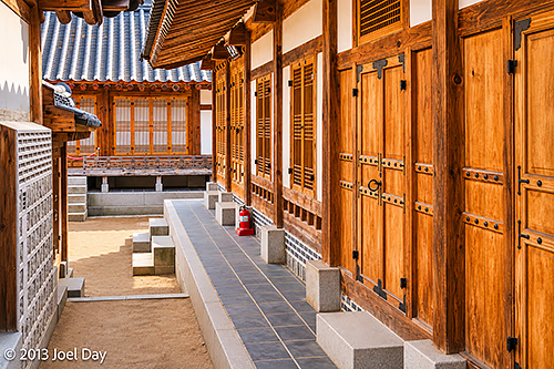
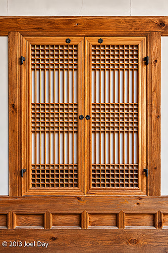
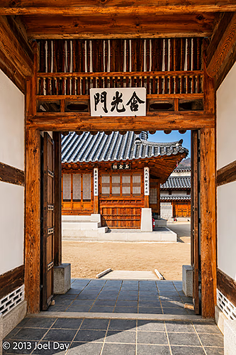
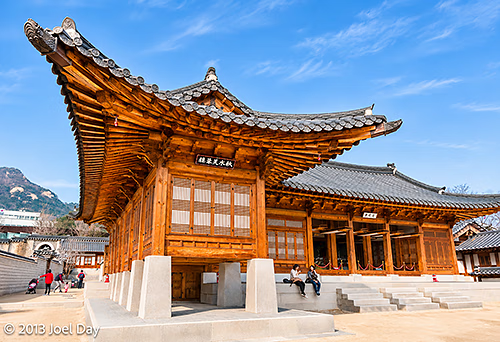
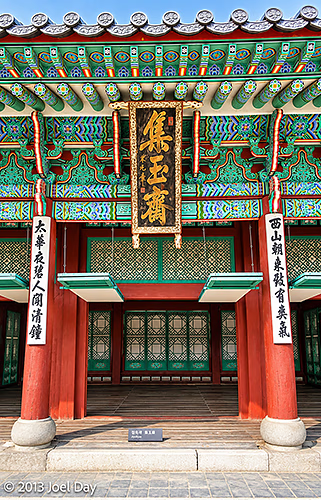
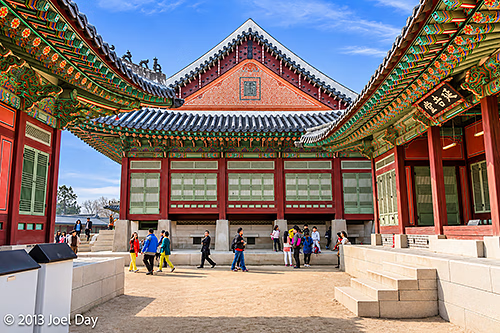
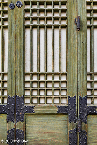
Traditional Folding Screen Depicting Gyeongbokgung Palace and the Surrounding Mountains – Seoul, South KoreaColourful Dancheong-Painted Eaves and Traditional Wooden Doors at Gyeongbokgung Palace – Seoul, South KoreaTraditional Royal Residential Buildings and Courtyard at Gyeongbokgung Palace – Seoul, South KoreaTraditional Joseon Dynasty Architecture and Colourful Dancheong Decorations at Gyeongbokgung Palace – Seoul, South KoreaTraditional Wooden Doors and Covered Walkway in the Jibokjae Royal Library Complex at Gyeongbokgung Palace – Seoul, South KoreaTraditional Wooden Lattice Window in the Jibokjae Royal Library Complex at Gyeongbokgung Palace – Seoul, South KoreaTraditional Wooden Buildings and Courtyard in the Jibokjae Royal Library Complex at Gyeongbokgung Palace – Seoul, South KoreaGeumgwangmun Gate Leading into the Jibokjae Royal Library Complex at Gyeongbokgung Palace – Seoul, South KoreaTraditional Wooden Architecture of Jibokjae Royal Library Complex at Gyeongbokgung Palace – Seoul, South KoreaOrnately Decorated Entrance to Jibokjae Hall at Gyeongbokgung Palace – Seoul, South KoreaTraditional Joseon Dynasty Palace Buildings Framing a Courtyard at Gyeongbokgung Palace – Seoul, South KoreaTraditional Wooden Lattice Doors with Decorative Iron Fittings at Gyeongbokgung Palace – Seoul, South KoreaHeungnyemun Gate at Gyeongbokgung Palace, Viewed from Inside the Palace Complex – Seoul, South Korea
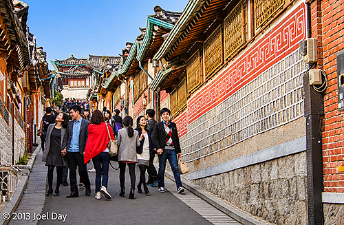
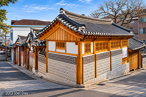
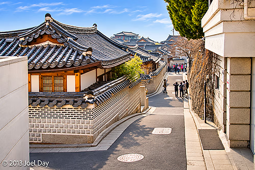
There were a few excellent free museums adjacent to the palace, one on the palace and another on Korean folk art. After leaving the palace, I strolled into a few busy historic neighbourhoods nearby, full of homes and shops preserved in traditional Korean architectural styles and owned by very wealthy people. And packed with many tourists!
Crowds of Tourists Walking Along a Narrow Street Lined with Traditional Hanok Houses in Bukchon Hanok Village – Seoul, South KoreaTraditional Hanok House at a Street Corner in Bukchon Hanok Village – Seoul, South KoreaNarrow Hillside Street Lined with Traditional Hanok Houses in Bukchon Hanok Village – Seoul, South Korea
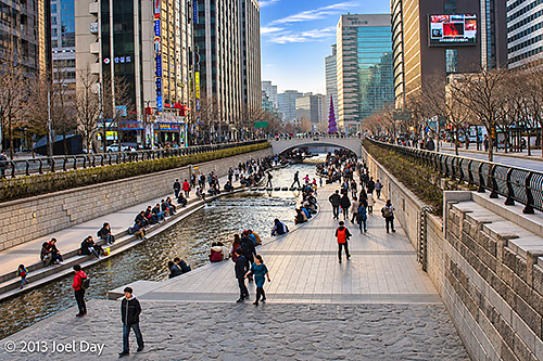
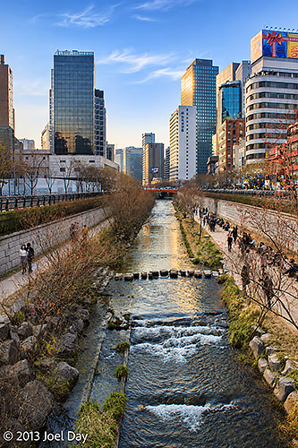
After that, I kept walking south into the centre of town through countless pedestrian malls closed to traffic, until I found a canal running alongside public walkways. Too bad they had a few too many foot-crossing stones permanently affixed – it would have made a great little whitewater paddling circuit!
Cheonggyecheon Stream and Pedestrian Walkways Surrounded by Modern Skyscrapers – Seoul, South KoreaCheonggyecheon Stream and Pedestrian Walkways Surrounded by Modern Skyscrapers – Seoul, South Korea
Seoul Snoop
Map of the route “Funky Seoul”: 4,883 m, 53 m of climbing and 82 m of descent, elevation between 15 m and 54 m, time 01:17:31. It starts at 37.58303, 126.98401 and ends at 37.56599, 126.97741 (latitude, longitude).
Or should I say, “I shall go to Korea if I can only get through China on the way!”
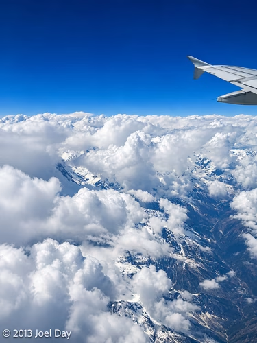
An eventful day, starting with another strike in Kathmandu that left the roads deserted of cars, but not people or rubble (placed there by protesters to hamper vehicular traffic). After our Air China flight finally took off, they announced in Mandarin that we were flying right past Mount Everest! Unfortunately, everyone on the right side of the plane got up and ran across the aisle to see it, which was a bit dicey. We were all disappointed because it stayed shrouded in clouds. Oh well. We continued on our way to Lhasa, Tibet.
Mount Everest hiding behind clouds
As we started our descent into Lhasa, they warned us about turbulence. Then the pilot suddenly announced in Mandarin that it was too dangerous to land due to a blizzard, so they’d skip it and fly straight to Chengdu. Many of the passengers began cheering, and I thought it was someone’s birthday, but then they translated it into English. Skipping a layover sounds nice, but it meant we arrived two hours early, and I was left with seven hours to kill without being allowed to go anywhere. I’m not sure how many on the plane were disadvantaged by the decision, but they stayed quiet.
Flight from Kathmandu, Nepal to Chengdu, China
Map of the route “I shall go to Korea.”: 2,004,319 m, 2,289 m of climbing and 2,991 m of descent, elevation between 572 m and 3,240 m, time 03:15:34. It starts at 27.69818, 85.35777 and ends at 30.56683, 103.94920 (latitude, longitude).
Once I arrived in Chengdu, I had to face immigration without a Chinese visa. They were actually very nice, but they confiscated my passport and told me I wasn’t allowed to leave the airport terminal. At one point, 5 Chinese officials escorted me around. I get the impression they don’t deal with too many transient visitors. Chengdu airport is huge, with many empty, unused gates. Even so, they forced our plane to park way out on the tarmac, with 90% of the gates empty, and bused us in. I managed to squeeze some Yuan out of an ATM so I could get some dinner after finally finding out how much it was worth, so I knew not to overdraw or underdraw my account.
When they confiscated my passport, I immediately asked how I would get it back (as I had never been asked to surrender it before). An official assured me that when it came time to check in for my midnight flight, the passport would be waiting at the check-in desk for me to pick up, and the flight staff would know about the whole situation.
Normally, you can’t check in in person until about 3 hours before your flight, so I wasted many an hour shuffling around the huge, empty terminal as it closed more and more shops in the evening. So I finally got my chance to check in, and I got to the check-in counter. Of course, the staff knew absolutely nothing about it. They also couldn’t check me in without a valid passport, so I was completely stuck. As it turns out, my passport was not at the check-in counter, but sitting in an immigration office about 300 meters away – behind a security zone, which required a passport and a boarding pass to get through, and next to the emigration queue that also requires the same plus a valid visa from the Chinese government.
Nobody at the check-in counter knew what to do about this conundrum until I quietly mentioned that I actually had two passports (which I never disclosed to the Chinese officials, but then again, they never asked). This got everyone excited because it offered a partial solution: I could get my boarding pass, which let me get through security and closer to the immigration office.
In the end, an airline official escorted me through security straight to the immigration office that held my other passport. They were able to get the managing Chinese official to come out, and he very nicely went to great lengths to expedite my acceleration through the final emigration line – even going so far as to actually fill in immigration forms for me so I could legally leave the country I was denied access to visiting in the first place. Now my passport has a Chinese emigration stamp even though I was never technically in the country.
I don’t know if I was their first ever transient passenger, but they obviously need to grease the wheels on their processes… But maybe it’s just the Chinese way of conducting business. Other countries usually offer a last-minute escape route for transients only there to catch connecting flights, which you usually find just before you reach the immigration desks. This keeps you in the emigration holding zone and lets you circumvent the issue, although I have heard Canadians complain about having to go through U.S. customs when trying to simply go south of the USA.
Everyone was always very nice, polite, and respectful in this episode, as you always are when dealing with government officials, and nobody ever suggested or even implied that I had ever done anything wrong, but… what a circus!
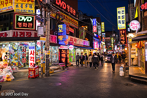
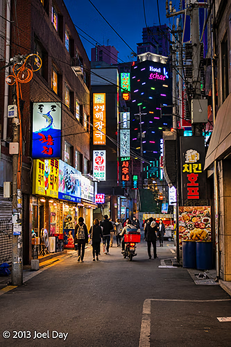
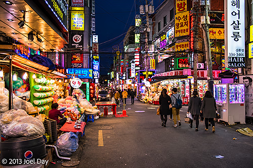
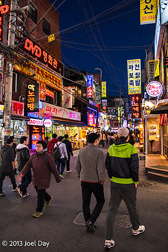
Fortunately, I made it to Seoul as scheduled and navigated the extensive train and subway network with my luggage to find my hotel.
Bustling Nightlife Street Illuminated by Neon Signs and Korean Restaurants – Seoul, South KoreaNeon-Lit Restaurants and Narrow Streets in Seoul’s Nightlife District – South KoreaBustling Nightlife Street Illuminated by Neon Signs and Korean Restaurants – Seoul, South KoreaBustling Nightlife Street Illuminated by Neon Signs and Korean Restaurants – Seoul, South Korea
Flight from Chengdu, China to Seoul, South Korea
Map of the route “I shall go to Korea.”: 2,488,330 m, 2,266 m of climbing and 2,254 m of descent, elevation between 445 m and 2,426 m, time 03:30:01. It starts at 30.58538, 103.95466 and ends at 37.44687, 126.44552 (latitude, longitude).
You must be logged in to post a comment.