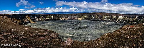
Kilauea Volcano, Hawai’i Volcanoes National Park, Island of Hawai’i, Hawai’i
As I mentioned before, the Big Island of Hawaii holds a few distinctions. Not only does it have the wettest city in the U.S. (Hilo), it also has the southernmost town in the U.S. (where I’m posting this blog entry: Naalehu), and the biggest mountain in the world (if you consider the fact that, unlike Mount Everest, it starts on the floor of the ocean).
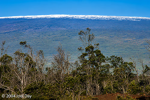
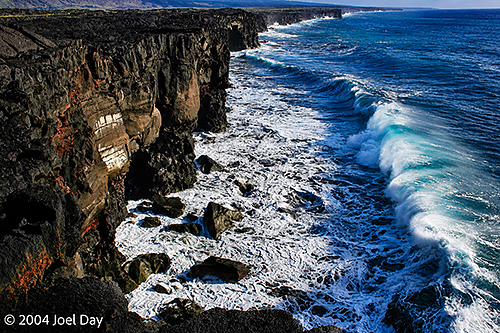
Snow-capped Mauna Loa Volcano in Hawai’i Volcanoes National Park, Island of Hawai’i, Hawai’iMauna Loa Lookout, Hawai’i Volcanoes National Park, Island of Hawai’i, Hawai’iPacific Ocean waves crashing into volcanic coast, Hawai’i Volcanoes National Park, Island of Hawai’i, Hawai’i
I spent the past few days camping and hiking on this world’s largest mountain while visiting Hawaii Volcanoes National Park. The park is a pretty amazing place with huge extremes in climate, elevation, and environments. The park runs from sea level up to a 13,700-foot peak covered in snow. There are about 150 miles of hiking trails throughout the park (including the summit trail), but it is best known for its very active volcanoes and lava flows.
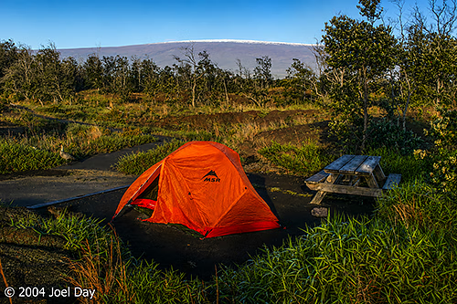
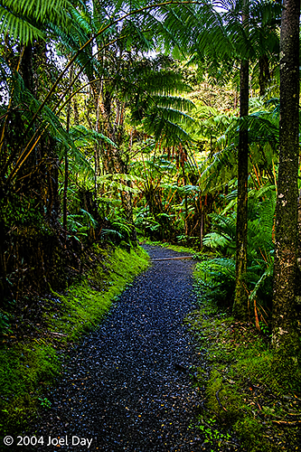
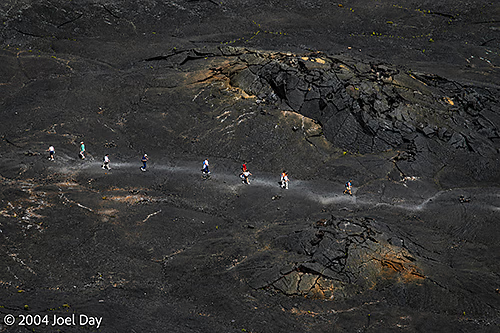
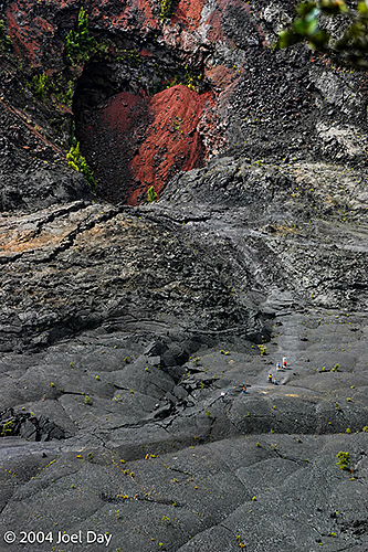
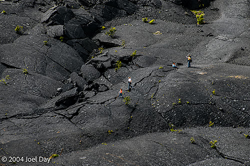
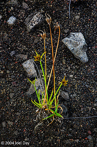
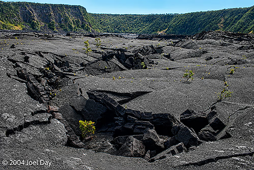
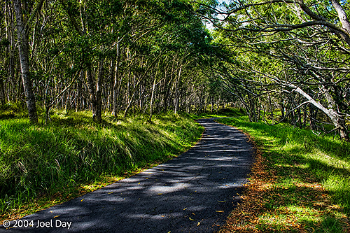
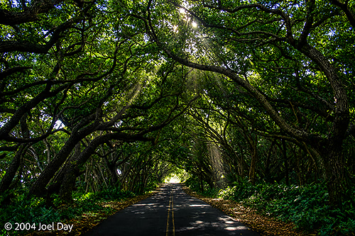
Camping in the shadow of the snow-capped Mauna Loa Volcano in Hawai’i Volcanoes National Park, Island of Hawai’i, Hawai’iRainforest walk in Hawai’i Volcanoes National Park, Island of Hawai’i, Hawai’iKīlauea Iki Crater Hike, Hawai’i Volcanoes National Park, Island of Hawai’i, Hawai’iKīlauea Iki Crater Hike, Hawai’i Volcanoes National Park, Island of Hawai’i, Hawai’iKīlauea Iki Crater Hike, Hawai’i Volcanoes National Park, Island of Hawai’i, Hawai’iGreen shoots growing out of volcanic soil, Hawai’i Volcanoes National Park, Island of Hawai’i, Hawai’iKīlauea Iki Crater Hike, Hawai’i Volcanoes National Park, Island of Hawai’i, Hawai’i
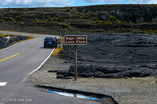
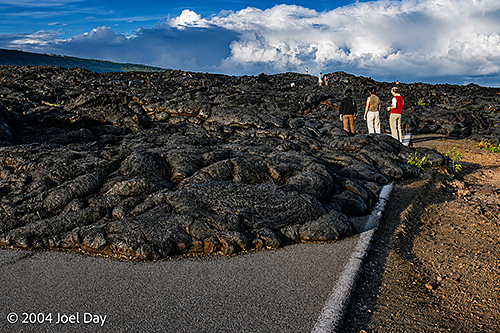
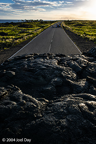
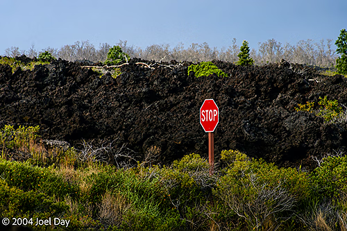
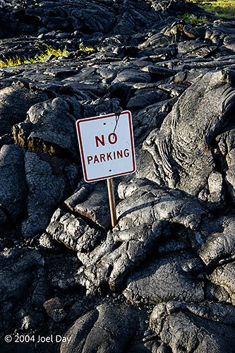
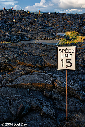
Hawaii Volcanoes National Park is the place you hear about lava flows in Hawaii, which crop up on the news every so often because they happen so frequently. The Big Island of Hawaii is the youngest of the Hawaiian Islands and continues to grow due to frequent volcanic eruptions. There are probably 15 or 20 active volcanic craters in the park, many of which have spewed lava in recent years. Throughout the park, there are huge hardened (cooled) lava flows that were making their way down to the sea before they froze into rock. You occasionally come to these clearings in the tropical growth along the road, where you’ll find nothing but black, hardened lava on either side. Signs are posted next to these flows indicating the years the lava flowed: 1959, 1974, 1982, 1998, 2002, 2003.
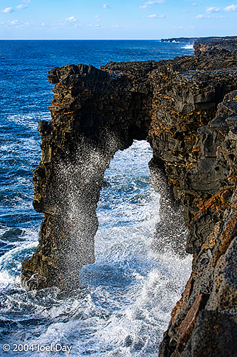
Lava Flow Path in 1982, Hawai’i Volcanoes National Park, Island of Hawai’i, Hawai’iHōlei Sea Arch, Hawai’i Volcanoes National Park, Island of Hawai’i, Hawai’i
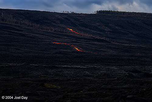
You can still see live (hot) lava flows in some parts of the park, which glow bright red at night. In other parts of the park, you can hike across craters that were last active in 1959 but continue to smell of sulphur as they steam off the rainwater that falls down into their cracks. They say these craters are much like frozen lakes, except instead of ice you walk on a relatively thin crust of rock. Instead of there being water below, you’re walking over magma — just a few hundred feet down. All of these active craters could wake up and erupt more lava at any time, but they seem better positioned to predict eruptions these days by closely monitoring seismic activity in the area.
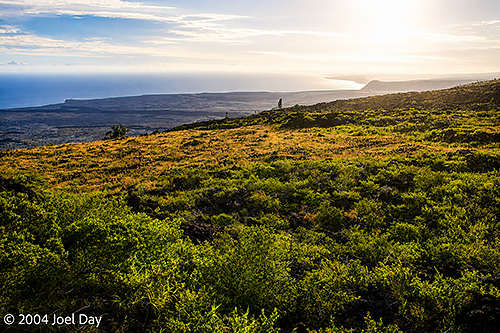
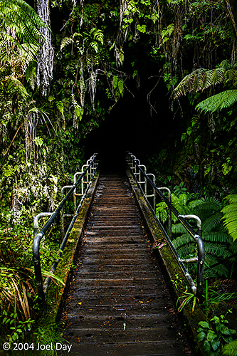
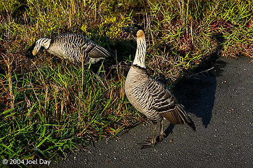
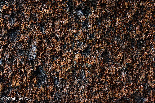
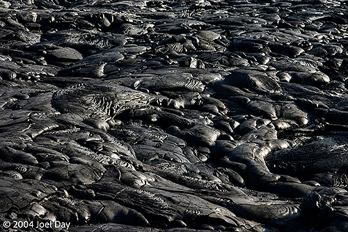
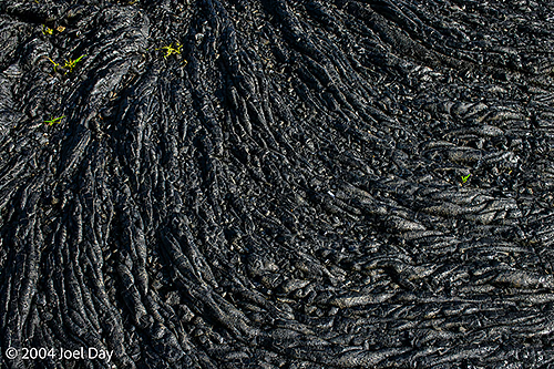
Lava glowing at night in Hawai’i Volcanoes National Park, Island of Hawai’i, Hawai’iEntrance to Nāhuku (Thurston Lava Tube), Hawai’i Volcanoes National Park, Island of Hawai’i, Hawai’iHike to Mauna Loa Lookout, Hawai’i Volcanoes National Park, Island of Hawai’i, Hawai’iNēnē, or Hawaiian geese (Branta sandvicensis), the state bird of Hawaii in Hawai’i Volcanoes National Park, Island of Hawai’i, Hawai’iVolcanic Rock Pattern, Hawai’i Volcanoes National Park, Island of Hawai’i, Hawai’i
Throughout the park, there were warnings about frequent earthquakes and fault lines opening up. There were also warnings about tidal waves, saying you should run from the ocean to higher ground if there are any earthquakes. Lava flows, earthquakes, and tidal waves have wiped out entire towns on this island in just the last century.
Hardened lava blocking road in Hawai’i Volcanoes National Park, Island of Hawai’i, Hawai’iHardened lava blocking road in Hawai’i Volcanoes National Park, Island of Hawai’i, Hawai’iHardened lava blocking road in Hawai’i Volcanoes National Park, Island of Hawai’i, Hawai’iHardened lava blocking road in Hawai’i Volcanoes National Park, Island of Hawai’i, Hawai’iHardened Lava in Hawai’i Volcanoes National Park, Island of Hawai’i, Hawai’iHardened lava blocking road in Hawai’i Volcanoes National Park, Island of Hawai’i, Hawai’i
After a few days in overpopulated Oahu (which is the home of Honolulu), I hopped on my long-planned flight to Hilo (pronounced Heel-o) on the island of Hawaii. As in New York State, people have to make the distinction between the state and the island, so they refer to the island of Hawaii as “The Big Island” (as opposed to the State of Hawaii — of which it’s part). Hilo holds the distinction of being America’s wettest city, getting about 6 meters of rain a year. Fortunately, the Big Island, roughly the size of Connecticut, is large enough that different parts of the state have distinct climates.
I spent my first couple of days roaming around the tiny city of Hilo (albeit the biggest on this island) just trying to get supplies. Hilo is probably not much bigger than Lititz or Manheim, PA (50,000?). And unfortunately, they have a Walmart. This means the city isn’t big enough to support both Walmart and small-shop owners, who are far more likely to be experts in their fields. The minimum wage paid to Walmart staff, as usual, meant they didn’t know anything about what they were selling. I also ran into this problem with K-Mart in some small Australian cities.
Getting used to shopping in American supermarkets again was another headache. Healthy food was awfully hard to find, with double-sugar here and triple-sized items there. Needless to say, this severely complicated my ability to get healthy, non-perishable camping food, camping fuel (I had to figure out what Australian “Methylated Spirits” translates to around here), and to get some basic, easy photo needs met (which were over the heads of Walmart employees).
Monkeypod or Rain Trees (Samanea saman) along road south of Hilo, Hawai’i
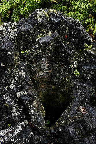
After about 24 hours of aggravation, I finally got out of Hilo and started heading down the west coast. The area, known as Puna, is famous for its hippies (or ferals, as we call them in Australia), rainforests, spectacular coasts, and volcanic remnants (including cool casts of trees caught in the lava). I found a hostel in the area with a very eccentric manager and lots of empty rooms. This seems like a really good time to visit Hawaii!
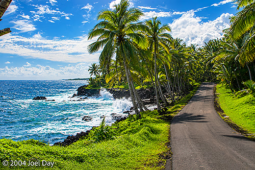
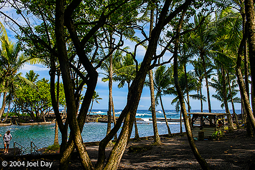
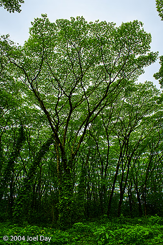
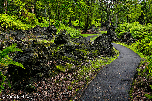
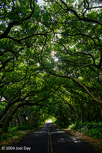
Palm Trees along coastal road south of Hilo, Hawai’iCoast south of Hilo, Hawai’iHot springs along coast south of Hilo, Hawai’iMonkeypod or Rain Trees (Samanea saman) along road south of Hilo, Hawai’iLava Tree State Monument, south of Hilo, Hawai’iLava Tree State Monument, south of Hilo, Hawai’iVolcanic terrain with green shoots south of Hilo, Hawai’iMonkeypod or Rain Trees (Samanea saman) along road south of Hilo, Hawai’i
After the longest day in my life, I found myself in Honolulu for a few days to recharge my batteries. I considered it my longest day because it started in Levuka, Fiji, when I flew back to Suva and then on to Nadi, where I had to wait for my departing flight to Honolulu at 11 PM. Of course, due to the International Dateline, I arrived in Hawaii at 7 AM the same day — giving me the opportunity to live through October 22nd twice — and in two different countries.
I checked into a hostel near the university where I found two roommates waiting for me in my dorm room. Oddly enough, one was from Perth, Australia, and the other was from Philadelphia, Pennsylvania. Talk about weird! It was funny to see the contrast in people between the two places I’ve spent most of my life. The Philadelphian, who was probably 15 years older than me, seemed to be primarily interested in pegging where I was on the class hierarchy that plays such a prominent role in the eastern U.S. by asking me lots of probing questions about what neighbourhoods I lived in and what schools I attended. The Australian guy, who was about 15 years younger than me, just seemed to want to be friends (not seeming to care anything about me other than the fact that I was from Perth). I didn’t feel I had a whole lot in common with either of them, but ended up spending most of my time with the Perth guy.
We visited the Pearl Harbor Memorial one day, which stuck me as a previous generation’s World Trade Center, and we did the popular hike to the top of Diamond Head the next morning. The Pearl Harbor Memorial was very interesting and a bit sobering. There was about a 2-hour wait to get out of the memorial, which is positioned on top of the sunken U.S.S. Arizona — which still contains the bodies of the sailors who died in the attack and still visibly leaks oil to this day. While you waited for the boat ride, there were exhibits you could go through.
Diamond Head is a non-active volcano which housed a defence fort for Honolulu (which was active during the Pearl Harbour attack), and it also happens to have a spectacular view of Waikiki from its top. It’s a pretty gruelling climb, but that didn’t seem to stop too many out-of-shape people.
Afterwards we visited the Waikiki Aquarium, which was full of beautiful tropical fish (just like I’ve been viewing by snorkelling in Fiji and Australia) and lots of cool hard and soft coral. Then we had a nice lunch in a cafe with a nice view to watch the world go by.
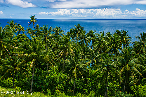
My final week in Fiji was spent in the historic former Fijian capital, Levuka, on the volcanic island of Ovalau, off the east coast of Viti Levu, the largest Fijian island.
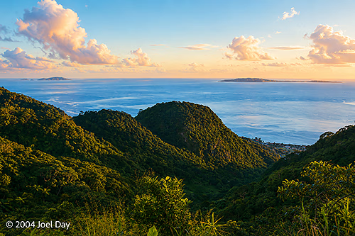
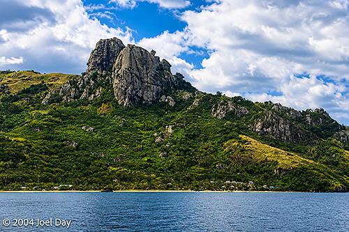
View from Volcanic Rim on Lovoni to Levuka Hiking Track, Ovalau Island, Fiji
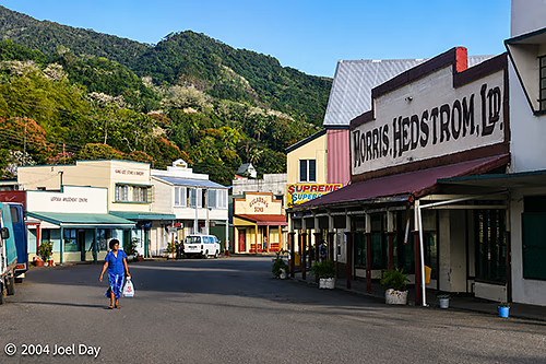
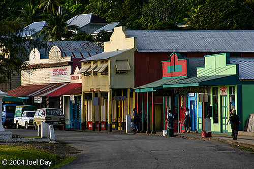
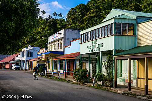
Levuka was the brief capital of Fiji for about 8 years in the 1800’s (just before it moved to Suva), and it continues to resemble a wild west town from that period — with many of the old colonial buildings still intact. Like most of Fiji, the locals were extremely friendly and hospitable, but very poor. It was nice to visit an area where you didn’t have the burden of merchants hawking their wares to you continually (like in Nadi). Nobody hassled you at all over there. Virtually everyone would just give you a big smile when they saw you and say “Bula!” (Fijian for “Cheers!”)
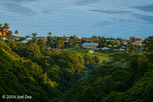
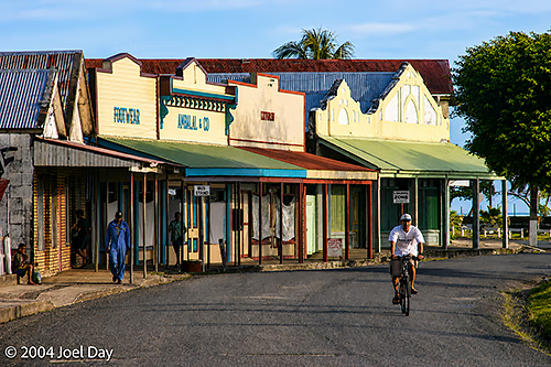
Early Morning on Levuka’s Main Street, Ovalau Island, FijiEarly Morning on Levuka’s Main Street, Ovalau Island, FijiEarly Morning on Levuka’s Main Street, Ovalau Island, FijiEarly Morning on Levuka’s Main Street, Ovalau Island, FijiEarly Morning on Levuka’s Main Street, Ovalau Island, Fiji
It was an interesting experience to go to the East Coast, away from most of the tourist sites. After spending a few days in a rain forest north of Suva (Fiji’s capital today), I opted to take the cheap route to Lavuka and ride the ferry with the locals to get out on the island. A mere 50-mile route became an arduous six-hour journey in a packed, cramped school-like bus, with everything imaginable sans livestock on board. All on a narrow, dangerous, bumpy road.
I was expecting to be on a ferry for most of the journey, but instead they bused us halfway up the coast for an agonising 3-hour ride to board a short ferry that runs out to the island (on the shortest stretch of sea). We had to wait an additional 2 hours for the ferry to arrive, empty, refuel, and fill up again, and then drive another hour after the ferry ride on a bumpy bus that took us around the perimeter of the island, stopping at each village along the way to drop off the odd passenger. I chose to fly back to Suva this morning to cut the aggravation, and it only took 12 minutes!
I stayed in the South Pacific’s oldest continually used hotel while in Lavuka. It was pretty well preserved from the colonial period in which it was built, and dirt cheap as well. I only paid FJ$20 a night (about US$12). Lavuka was a taste of the real Fiji, but it was also a bit frustrating as a short-term tourist. It was hard to do too many activities because of the lax attitude of many tourism businesses there (often run by Europeans who would just tell you to come back tomorrow).
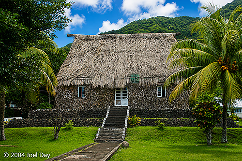
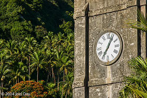
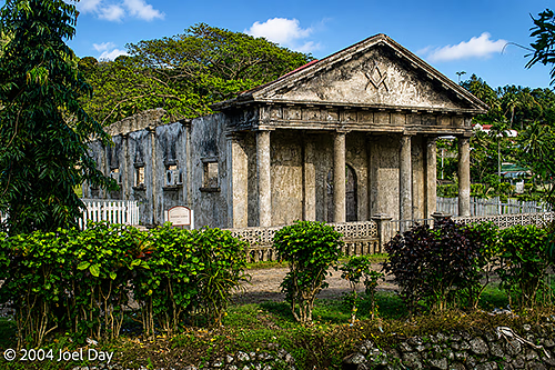
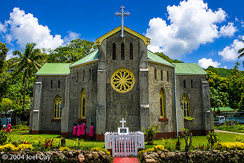
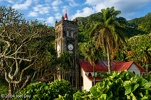
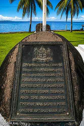
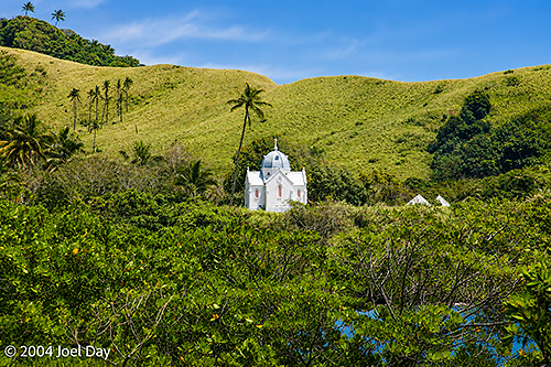
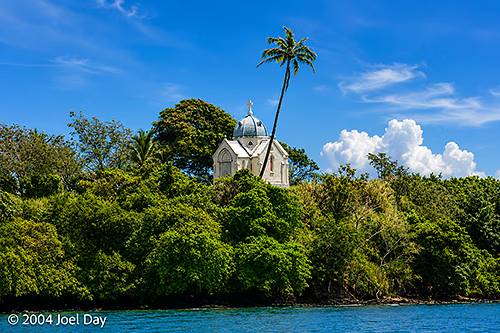
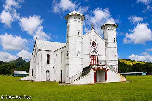
Traditional Fijian Bure, Levuka, Ovalau Island, FijiSacred Heart Parish Catholic Church, Levuka, Ovalau Island, FijiHistoric Masonic Lodge in Levuka, Ovalau Island, FijiSacred Heart Church, Levuka, Ovalau Island, FijiSacred Heart Parish Catholic Church, Levuka, Ovalau Island, FijiLevuka Deed of Cession, Ovalau Island, Fiji
The most memorable excursion out there was probably the visit to the head village of Lovonie (in the centre of the crater in the middle of the island) and the treacherous hike back up over the crater rim and back down into the coastal town of Levuka. The journey was led by a local guide who’s been doing this tour for ten years and involved trekking through dense jungle on an overgrown track. Like every other hike I’ve had in Fiji, the guide had to rely on a machete to hack through overgrown jungle throughout the hike. There were only three of us doing the hike that day, and the guide explained to us that he usually cancels if there are fewer than four — but agreed to take us for the hike if we agreed to take public transportation (the back of a truck) to his village for the included traditional lunch and storytelling.
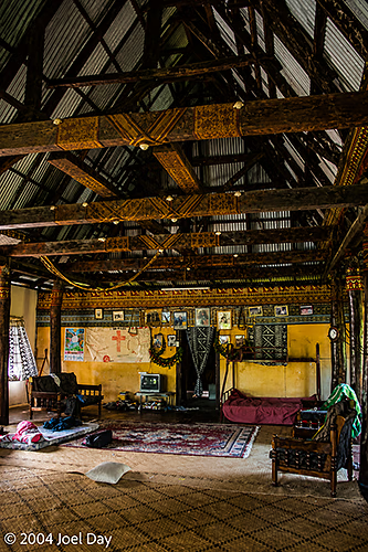
Chief’s House, Lovoni Village, Ovalau Island, Fiji
The only problem was that the delay caused by relying on public transportation forced us to start late. In addition, the three of us chose to do a more strenuous, longer trail that our guide hadn’t used in months. As it turned out, we reached the peak at sunset and ended up hiking down through the dense jungle in the pitch-black. The trail was quite treacherous (especially at night), and I was sure at times we were going to have to sleep out up there in the jungle that night — but our guide came through and built torches from dried banana leaves to illuminate our way through the pitch-black, dense vegetation. He was quite embarrassed about the whole affair and keen to sneak back into town without letting the locals know what had happened. He kept trying to buy us dinner and beer afterwards to make up for it.
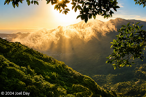
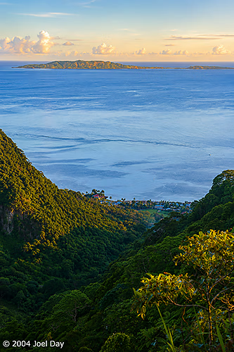
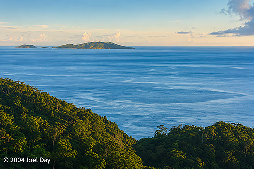
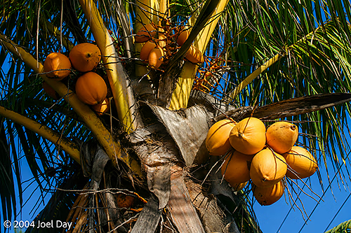
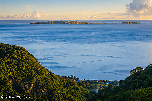
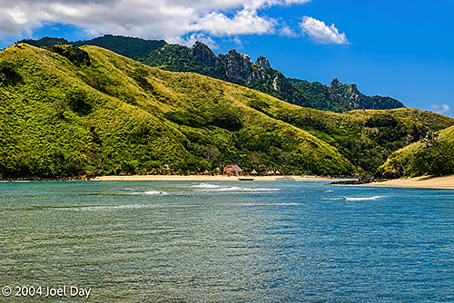
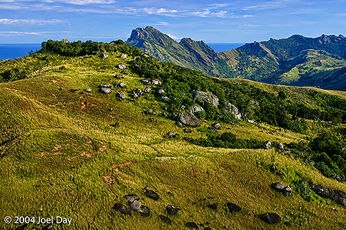
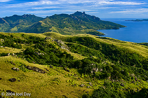
View from Volcanic Rim on Lovoni to Levuka Hiking Track, Ovalau Island, FijiView from Volcanic Rim on Lovoni to Levuka Hiking Track, Ovalau Island, FijiView from Volcanic Rim on Lovoni to Levuka Hiking Track, Ovalau Island, FijiCoconuts, Ovalau Island, FijiView from Volcanic Rim on Lovoni to Levuka Hiking Track, Ovalau Island, FijiView from Volcanic Rim on Lovoni to Levuka Hiking Track, Ovalau Island, Fiji
I also managed to get a bit of cycling around part of the island’s perimeter (where the only road runs) and do a bit of snorkelling off the coast. The snorkelling was quite good with lots of colourful tropical fish and coral — when you got away from the polluted villages. The locals seemed a bit baffled at what the tourists got up to: Snorkelling? Why would people do that? We use the ocean to fish, but otherwise just throw our trash in there. Adults on bicycles? A scene that makes the local children point and laugh.
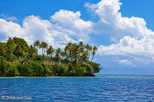
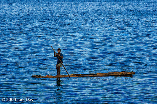
The Bishop’s Tomb Historic Site, Cawaci, Ovalau Island, FijiCoastal Palm Trees on East Coast of Ovalau Island, FijiMan Paddling Handmade Raft on Sea along Ovalau Island, FijiCoastal Palm Trees on East Coast of Ovalau Island, FijiThe Bishop’s Tomb Historic Site, Cawaci, Ovalau Island, FijiSt. John the Baptist Catholic Church, Cawaci, Ovalau Island, Fiji
Fijians consider it rude to just rock up to a village without an invitation. You are supposed to ask to see the village chief when you arrive in a village and give them a gift, like Kava, in exchange for passage through the area. Needless to say, it gets a bit awkward trying to explore very far because you’re always stumbling across villages, and it’s time-consuming to continually have to meet with the chief to ask for permission. As I’ve said before, the people in the villages are very friendly, but very poor. Most homes are hot tin shacks with no furniture. Entertaining is done by sitting on woven mats on the floor. And despite this lack of wealth, they will offer you their food — which you are really expected to accept.
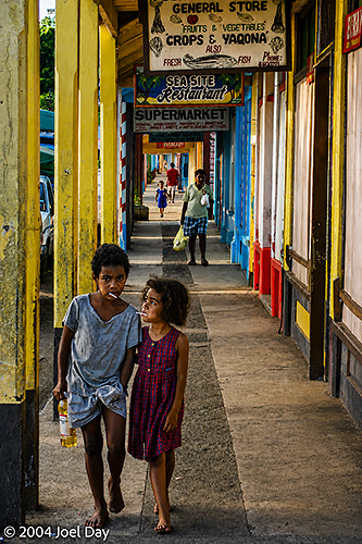
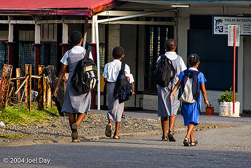
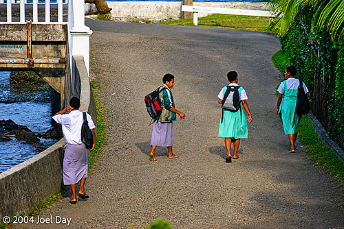
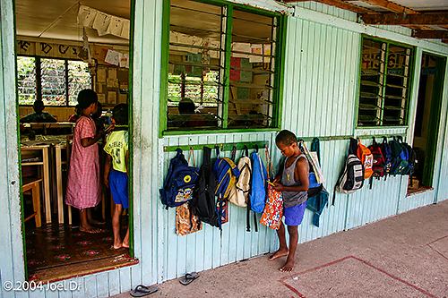
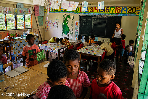
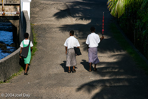
Children walking to School, Levuka, Ovalau Island, FijiChildren walking to School, Levuka, Ovalau Island, Fiji
Unfortunately, many villages are not the most sanitary, so you really have to be careful with their generosity. While the water is safe in the resort areas and big cities of Suva and Nadi, it is not safe in these small villages. I had to keep pointing to my Fiji water bottle every time someone tried to offer me water while I cycled through their villages, to avoid drinking their local water (and getting sick).
It was quite distressing to see how the locals regarded their beautiful ocean and reefs. I can’t tell you how many times I saw Levukians bundle up big bags of trash and just throw them into the ocean. The coast along the villages and towns was littered with trash. There were also plenty of other serious health concerns around the area. I spent some time with a retired American public health worker who pointed out all kinds of problems to me, including lots of raw sewage draining untreated into the sea and half the kids running around with ringworm (which you can evidently see as a fungus growing on their forearms). I think the place’s sanitation caught up with me yesterday, when I came down with a bad bout of food poisoning and couldn’t get out of bed for most of the day.
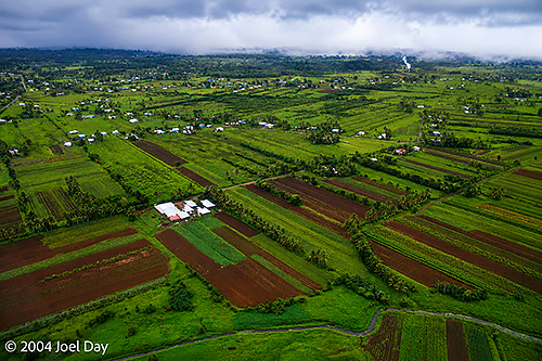
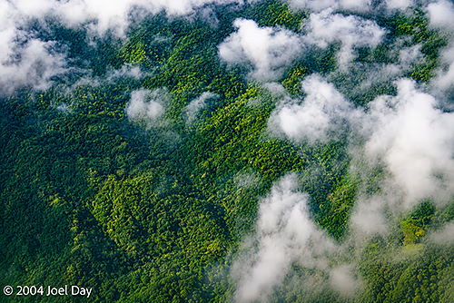
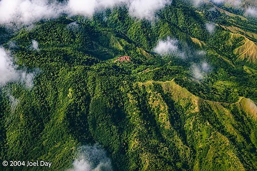
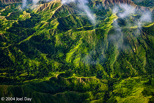
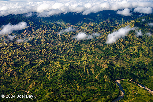
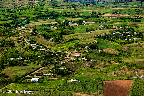
Here are some photos from the flights I took from a jungle mountain airstrip on Ovalau Island to Suva, and then on to Nadi:
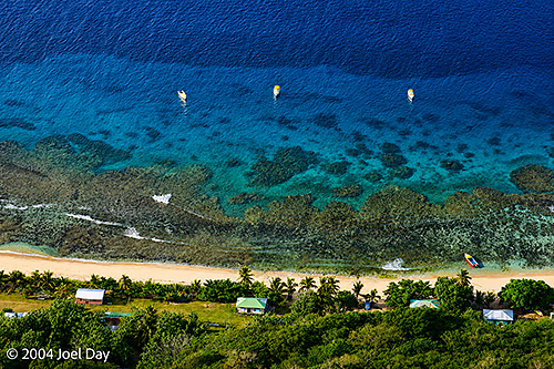
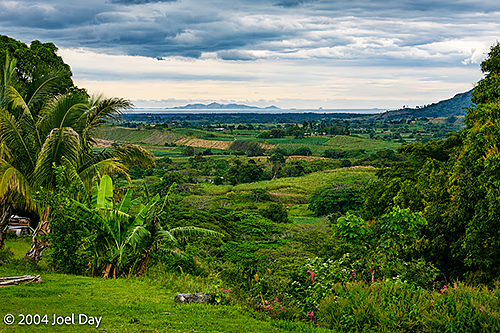
Aerial Images of Rural FijiAerial Images of Interior FijiAerial Images of Interior FijiAerial Images of Interior FijiAerial Images of Interior FijiAerial Images of Rural Fiji
I’m now in Suva, the capital of Fiji. I took a mostly harrowing bus ride over here from Nadi on the only paved road in the country, but arrived safe and sound. Suva only has a population of about 350,000, but it is still not considered the safest place to visit after dark. It is also a city ringed by armed checkpoints. Guess they’re watching out for the next coup d’etat.
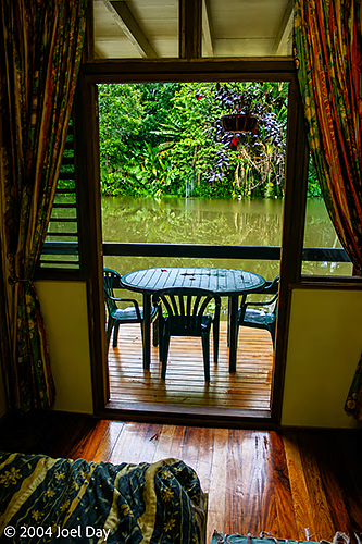
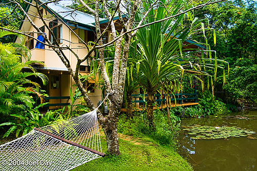
Guestroom near Suva, Fiji
I chose to stay about 20 minutes out of town, in a rainforest area, at a wonderful lodge with rooms overlooking lakes. I went on a wonderful hike through a rainforest park to a deep swimming hole with a great rope swing this morning, then came into the city to see the sights this afternoon. Went to the Fiji Museum and learned all about cannibalism today. Lots of nasty-looking cannibal forks and other cannibal tools on display. They seemed to shy away from some of the more controversial aspects of Fiji history and played down the cannibalism as something that exists in all of our histories — with even a portrait of Jeffrey Dalmer and other recent cannibals (which seemed to offend just about everyone I know who saw it). Although Indians make up half of Fiji’s population today, they were only mentioned in an exhibition in a small upstairs room.
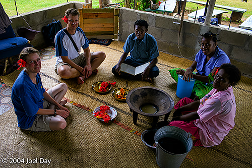
After a string of days on the islands, I decided to head back to the mainland for a mountain bike tour of the hills outside of Nadi. There were a couple of cycling options, but I chose a bike-and-hike tour that took us up into the hills through some small villages and to a traditional Fijian house. We took a break from peddling, drank Kava (as one does), and began hiking up into the rainforest to a chilly swimming hole next to a large mountain known as “The Sleeping Giant”.
Kava Ceremony in Fiji
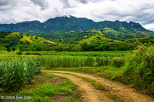
Along the way, we munched on snacks from the surrounding fields, including grapefruit, papaya, bananas, and pineapples. We also gnawed on sugar cane stalks to reach the sweet juice. Afterwards, we hiked back down to the same house for a wonderful traditional Fijian lunch before cycling back downhill to the coastal plain. A good workout and a satisfying day.
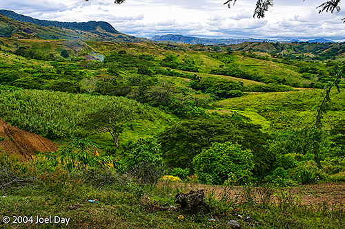
Mountain Bike Circuit through Sugarcane Fields in FijiMountain Bike Circuit views of the Fiji Countryside
An Australian couple who rode with me on this trek had just spent the past week at one of Fiji’s posh resorts. They just decided on a whim to try roughing it for a day to see what life was like outside of their sterile enclave. While for me this day was in the same vein as other eco-tourism experiences I’ve had, they were totally blown away by the richness of immersing themselves in the Fijian culture and rubbing shoulders with the locals.
Probably the best time I’ve had since I started my travels has been at an eco-tourism resort on Wayalailai Island in the Yasawa Islands chain, west of Nadi. The resort was owned and run by three indigenous Fijian villages on the island. They were very warm and hospitable, great cooks, and took us on a variety of adventure tours in the area — including lots of spectacular snorkelling and hiking atop mountains overlooking the sea. Many of the older men on the island wore the traditional Fijian outfit of a sulu (skirt) and a red hibiscus flower in their hair.
Ecotourism resort on Wayalailai Island, Yasawas Island Group, Fiji
The accommodation was quite rustic (with no power for most of the day and only fresh local spring water to drink), but everyone staying there seemed to be really enjoying themselves (and the traditional food). Three meals a day were included in the very reasonable prices (FJ$30-50 a day). The villagers would serenade us with traditional Fijian music all evening while we sat around talking. It was really wonderful.
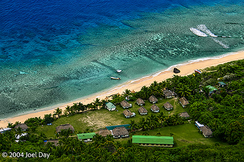
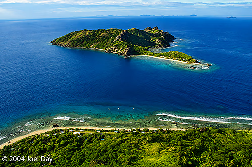
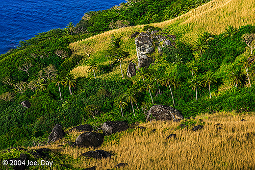
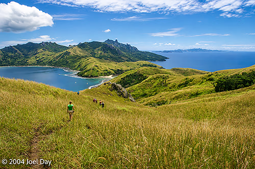
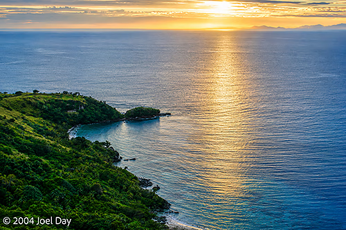
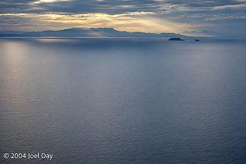
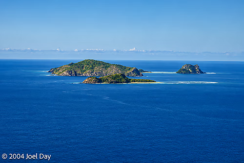
Kuata Island viewed from top of Wayalailai Island, Yasawas Island Group, FijiView from the top of Wayalailai Island, Yasawas Island Group, FijiWayalailai Island, Yasawas Island Group, Fiji
The best thing was that the money we paid them went directly toward improving the villages on the island (which reminded me of the villages I encountered in Venezuela, with chickens running around, back in the early 1970’s) instead of some guy’s Lexus payments. It warmed our hearts to go on tour over mountain tops through the island’s villages on the last day I was there to see these things. Parts of the movie Cast Away were filmed on some nearby islands we visited. I ended up spending four nights there, hiking, swimming, snorkelling, playing volleyball, and socialising with the others.
View from the top of Wayalailai Island, Yasawas Island Group, FijiView from the top of Wayalailai Island, Yasawas Island Group, FijiView from the top of Wayalailai Island, Yasawas Island Group, FijiHike across Wayalailai Island, Yasawas Island Group, FijiVillage on Wayalailai Island, Yasawas Island Group, FijiSchool on Wayalailai Island, Yasawas Island Group, FijiSchool on Wayalailai Island, Yasawas Island Group, Fiji
After spending the past nine weeks racing around Australia and New Zealand, it was nice to just chill out and relax for a change.
Sunrise viewed from the top of Wayalailai Island, Yasawas Island Group, FijiView from the top of Wayalailai Island of Yasawas Island Group, Fiji
I flew into this tropical paradise without any reservations, hoping to just wing it and get a discount for rocking up unannounced. The travel books warn of the touts you’ll face at the airport, hawking their cousin’s accommodation (one of the customs officials was even doing it) — but the travel guides recommend taking refuge from them in the Fiji Visitors Bureau at the airport.
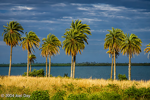
Fiji Palm Trees
As luck would have it, the old FVB shut down and has allegedly moved somewhere between the airport and the town of Nadi, but I haven’t been able to find it yet. Maybe it never really existed. I ended up in a small hotel halfway between the airport and the city with questionable security (it looks like the door has been kicked down a few times), cleanliness (which is what my pre-trip travel immunisations were for), and no air conditioning. It has a ceiling fan instead of air conditioning, but it was cool enough to shut off the fan by 8 PM last night. They have nicer places, but they’re a lot more expensive than what I am willing to pay.
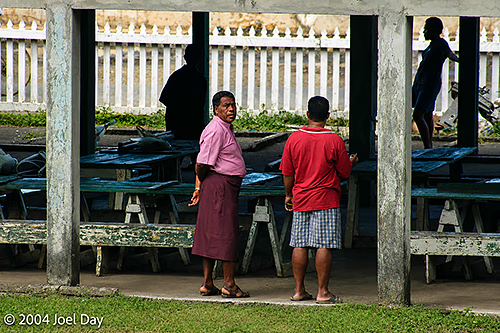
I wandered into the town of Nadi (pronounced “Nandi”) this morning, and found that there really isn’t much to it. It’s basically one main street that runs for about 4 or 5 blocks. All traffic was stopped when a small-gauged sugar cane train roared through town towards the sugar mill. The town itself is full of little Indian merchant shops, much like Little India in Singapore — all hawking their wares to the visitors (which gets annoying). One of my first impressions of the town was a long line of school students, both boys and girls, all wearing skirts. Yes, the guys often wear a “sulu” here, which is essentially a men’s skirt.
Men wearing Sulus in FijiChildren walking to School, Levuka, Ovalau Island, Fiji
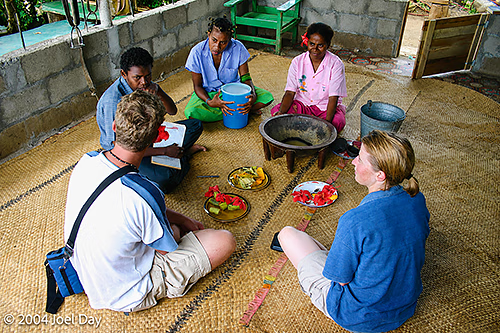
Within my first hour of strolling around town, I was continually pitched products and finally succumbed to my first Kava ceremony on the pretence of a shop owner just wanting to be friendly to the visitors. Kava is a drink made from the roots of a pepper plant and is said to have medicinal properties. It’s an ancient Fijian custom. I can’t say it tastes great (sort of like ground wood), but I survived okay. A few other tourists were dragged in while I was there. We were welcomed, but warned off buying anything from the big-business Indians. Oddly, the shop owner seemed Indian. Seems like those coup tensions from a few years ago still haven’t worn off. Sure enough, I was given a hard sales pitch afterwards for buying their hand-carved trinkets to help their poor indigenous Fijian village. I later met other tourists who had been lured to the same selling scheme. We concluded that they probably had no ties to the village, and only used it because it was mentioned in a Lonely Planet guide they knew we were all carrying. I decided to walk back to my hotel, only to have every taxi driver and bus toot at me to see if I wanted a ride.
Kava Ceremony in Fiji
I have booked a catamaran ride to a small neighbouring island tomorrow, where the nicest part of Fiji is supposed to be. It’s in the string of islands where Tom Hanks’ “Cast Away” and Brooke Shields’ “Blue Lagoon” were filmed. Lots of white sandy beaches, great snorkelling, huts on the beach, and good hiking trails. I’m not expecting them to have Internet access, so it might be 3-4 days before I write again.
View from the top of Wayalailai Island of Yasawas Island Group, Fiji
After my West Island jaunt, I will probably take a bus to Suva (the capital city), a traditional village, and visit some other recommended islands to the north and east of the main island.
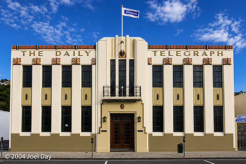
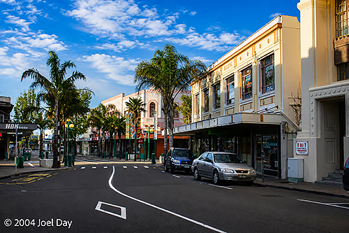
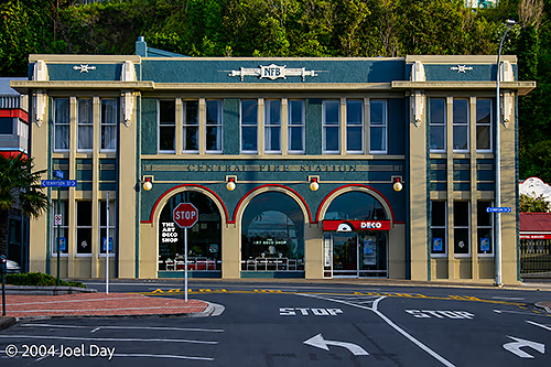
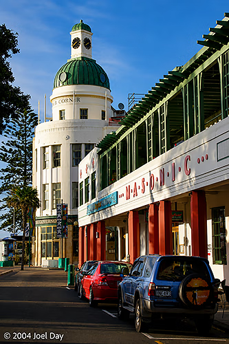
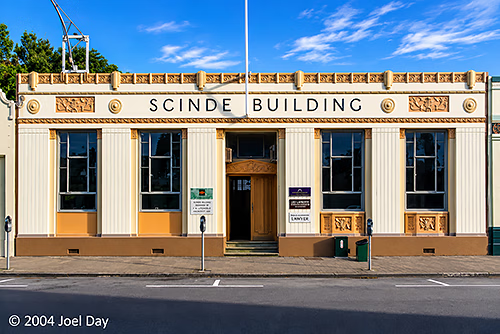
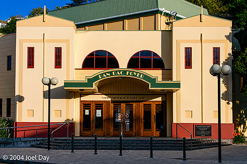
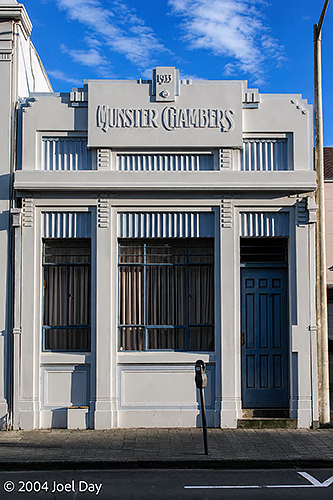
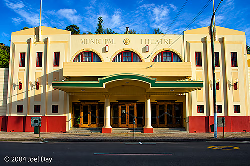
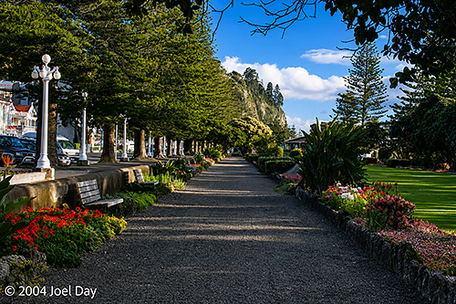
Art Deco Architecture in Napier, North Island, New Zealand
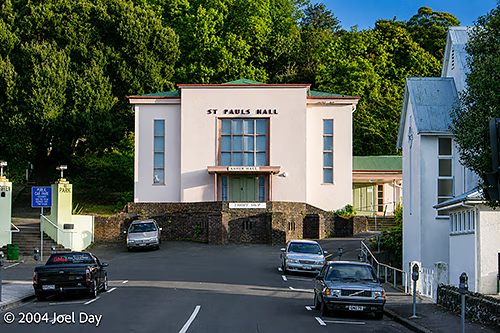
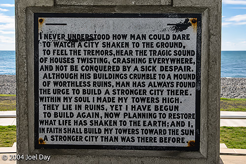
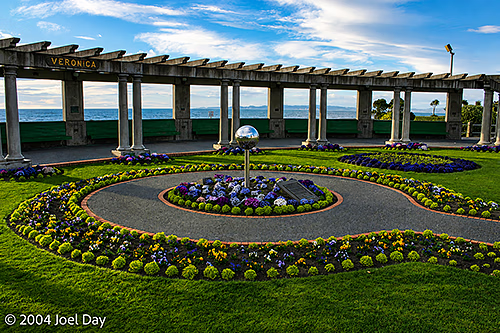
Three weeks later, I’m back in Auckland again — but not before a pit stop in Napier (on the east coast of the North Island). Napier’s big tourist draw, besides its vineyards, is its architecture. In 1930, an earthquake measuring 7.9 on the Richter scale levelled the place and raised a shallow bay above sea level. The entire town was rebuilt over the next few years, and the prevailing style was Art Deco. There are still many buildings left from that period, and they’re all preserved to showcase to the town’s visitors. The formerly submerged bay is now their airport. It was a nice little town to duck into for the night on my way across the North Island to Auckland.
Art Deco Architecture in Napier, North Island, New ZealandArt Deco Architecture in Napier, North Island, New ZealandArt Deco Architecture in Napier, North Island, New ZealandArt Deco Architecture in Napier, North Island, New ZealandArt Deco Architecture in Napier, North Island, New ZealandArt Deco Architecture in Napier, North Island, New ZealandArt Deco Architecture in Napier, North Island, New ZealandArt Deco Architecture in Napier, North Island, New ZealandCommemorative Plaque in Napier, North Island, New ZealandMarine Parade Parks in Napier, North Island, New ZealandMarine Parade Parks in Napier, North Island, New Zealand
Tomorrow I’m hopping on a plane to Nadi (pronounced “Nandy”), Fiji. I’m looking forward to the warmth, even though Auckland feels pretty good right now.
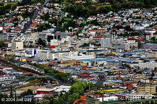
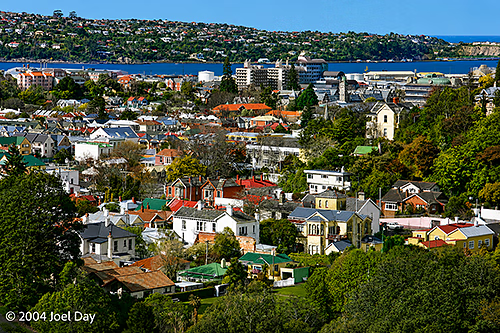
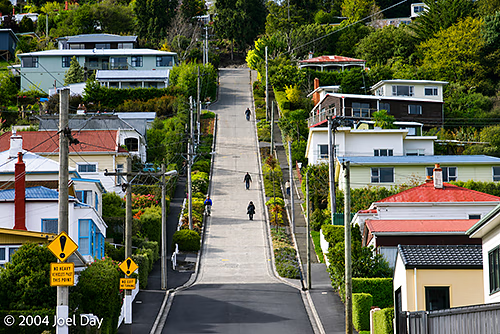
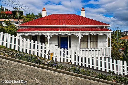
After spending a mere 15 hours in freezing Dunedin, where I hiked up the world’s steepest street and inhaled the smell of chocolate from the Cadbury plant, I started heading north to the fork in the road where I could either head for Mount Cook or Christchurch (the South Island’s largest city).
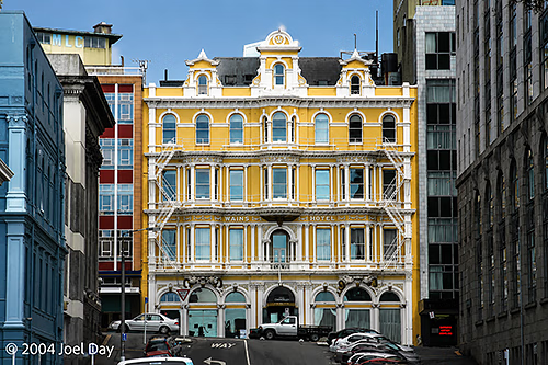
Dunedin, South Island, New ZealandHotel in Dunedin, New ZealandBaldwin Street, Dunedin – The Steepest Street in the WorldHouse on Baldwin Street, Dunedin – The Steepest Street in the World
Once again, I found myself driving in the pouring rain. I decided to skip Mount Cook for fear that after a long drive, it would be shrouded in clouds. Instead, I ended up in Christchurch, hoping to spend a full day snooping around. I had a very hard time finding any accommodation in Christchurch. As it turns out, New Zealand and Australian school students have been enjoying a 2-week break — so everything was booked solid. Except for the YMCA, where I ended up. The Y was actually quite nice. Probably nicer than any other place I’ve stayed on this trip — but it was missing the social feel you get from hostels. It was also a tad more expensive. The hostels were all booked out by entire families on vacation, as hostelling in New Zealand is a pretty mainstream activity.
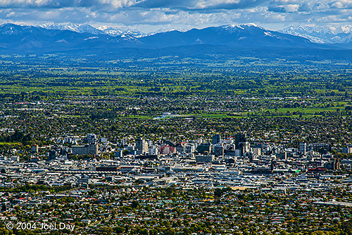
Christchurch, South Island, New Zealand
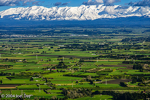
Christchurch was nothing to get too excited about. It looks better from a distance than from within. Or, at least, there wasn’t much to it. I have to give my vote to Wellington when it comes to New Zealand cities. Wellington seems to be like hilly San Francisco, Auckland like overcrowded New York, and Christchurch like Los Angeles (flat, at the base of snow-capped mountains — but without any freeways).
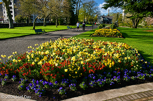
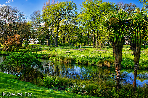
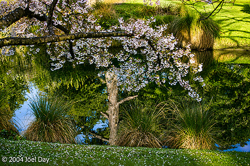
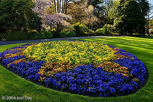
Christchurch Botanic Gardens, South Island, New ZealandChristchurch Botanic Gardens, South Island, New ZealandChristchurch Botanic Gardens, South Island, New ZealandChristchurch Botanic Gardens, South Island, New Zealand
I decided to geek out in Christchurch and visit the overpriced Antarctic Museum. I guess because I couldn’t fit Antarctica into my itinerary any other way on this trip. It was a pretty good show, but mainly aimed at kids with lots of wiz-bang interactive stuff (including a windy chill room you could go into to see what the South Pole felt like). The museum was actually located at the Christchurch airport. Why? Because that’s actually where several countries funnel their supplies to the bases in Antarctica. Right across the street from New Zealand’s Antarctic offices were the United States’ Antarctic offices. Behind chain-link fences along the road, you could see long strips of supplies on pallets under netting, waiting to be slid onto Hercules Transport Planes for delivery to the South Pole. I thought it was pretty cool. They do 2 flights down there a week.
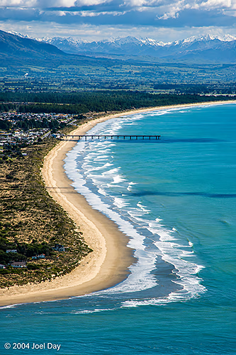
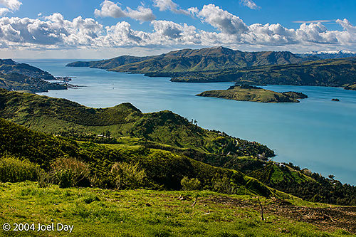
Farmland and Mountains near Christchurch, South Island, New ZealandSouth New Brighton Beach, Christchurch, New ZealandBay south of Christchurch, South Island, New Zealand
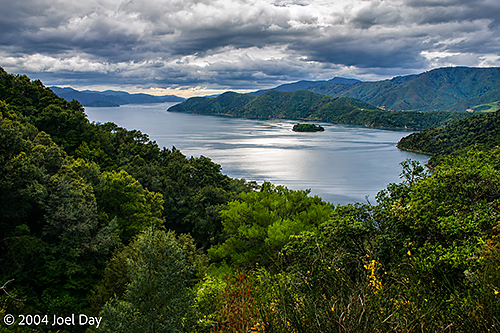
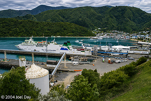
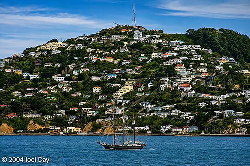
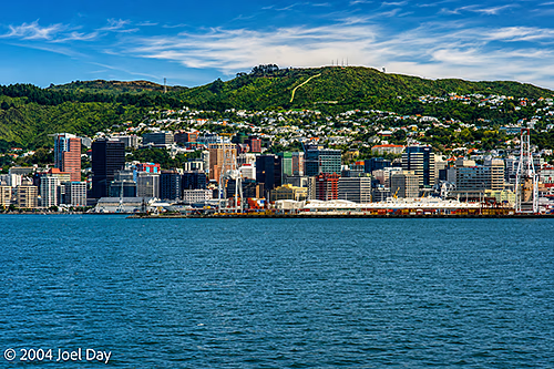
Although they wouldn’t accept me as a guest, the YHA people in Christchurch were very nice and helped me secure reservations at a string of hostels that will lead me back to Auckland in time for my flight to Fiji on Wednesday. I’ve been retracing a few places, but I will get the chance to visit Napier on the east coast of the North Island after sailing into Wellington on the ferry tomorrow morning. I’m presently chilling out, cleaning up, and packing up tight for the journey back here in the Havelock schoolhouse hostel where I started on the South Island ten days ago.
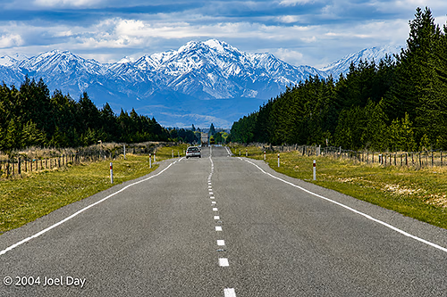
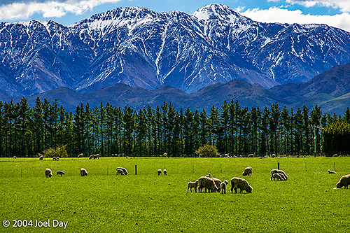
Highway across South Island, New ZealandSheep grazing on South Island, New ZealandQueen Charlotte Sound, South Island, New ZealandWellington-Picton Interislander Cook Strait Ferry loading in Picton, South Island, New ZealandTall Ship in Wellington, North Island, New ZealandWellington, North Island, New Zealand
You must be logged in to post a comment.