I woke up early in the chilly Kathmandu air to wolf down breakfast and meet my driver so we could head to Sauraha, near Chitwan National Park in south-central Nepal, close to the Indian border. It was about a 4-hour drive on mainly switchback mountain roads, descending about 1200 meters back to the warm, sunny plains. Although the traffic didn’t seem quite as crazy as in Sri Lanka, there were some horrible-looking accidents and many broken-down trucks and buses left in the middle of the narrow road for everyone to try to navigate around. At times, landslides made road conditions atrocious, likely due to the summer monsoon season. Lots of dried, muddy stretches with massive potholes. As it turns out, the road is the main drag between Kathmandu and India.
The Drive from Kathmandu to Chitwan National Park
Map of the route “Pothead and Peacock Central”: 149,761 m, 947 m of climbing and 2,061 m of descent, elevation between 193 m and 1,466 m, time 04:57:19. It starts at 27.71242, 85.31145 and ends at 27.58223, 84.49427 (latitude, longitude).
I arrived at a compound behind a gate with staff members dressed like Gurkha soldiers. Probably not a coincidence, since Gurkha is a town just up the road. The gate rolled open and about five guys descended on me with juice on a tray and help with my bags. The manager greeted me in the reception area. He proceeded to sit down with me and go over, point-by-point, my schedule (with military precision) for the two days that I’m there. I will be woken early in the morning for safaris, canoe trips, elephant rides, etc. All meals will be provided during my stay at precise times.
Oddly, while it is a moderately sized compound, I didn’t see any other tourists staying here. I have all these staff members at my beck and call, but it looks like they have no one else to serve. They seem very eager to please! Perhaps it’s a new hotel, and they are keen to establish their reputation.
The hotel room itself is like many I have come across in my travels through Sri Lanka and Nepal. On the surface, it looks modern and well presented, but you soon notice many broken and unfinished things. The TV doesn’t work, the air conditioning doesn’t work, you sit on the bed, and a large slat falls to the floor beneath you, there is barely any water pressure, the sink fixtures aren’t secured to the counter, etc. You simply pretend not to notice and, when asked, say you think everything is great!
By the time my late afternoon tour rolled around, it became apparent that I was, in fact, their only guest. It is a little weird to have an army of staff constantly standing around watching me eat and asking individually whether everything was okay. One guy in particular seems to take me on a tour every day. He is very nice and quite passionate about the local culture here in the flatlands and the area’s wildlife, which is always nice. He’s not from the area, so he sees things as an outsider, too.
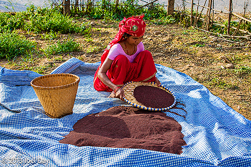
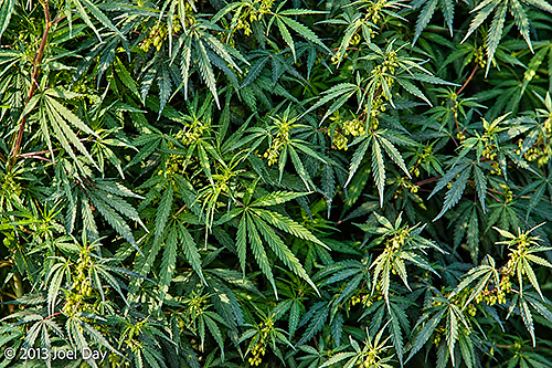
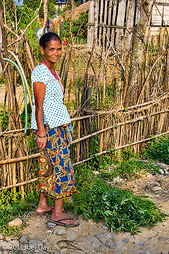
Among the interesting aspects of the neighbourhood are patches of marijuana freely growing everywhere. The locals were harvesting bunches to sell on to India and Kathmandu – even though it is still illegal here. They didn’t even mind me taking pictures of them working their crop, stopping to smile proudly next to their piles of freshly cut weed.
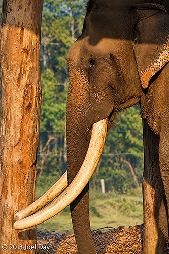
Chitwan National Park is another UNESCO World Heritage Site. Evidently, Nepal has more UNESCO World Heritage Sites than any other country in the world, so much so that it is not permitted to have any more. The park is supposed to have elephants, rhinos, tigers, deer, peacocks, and plenty of other exotic birds. I will see what I can find tomorrow.
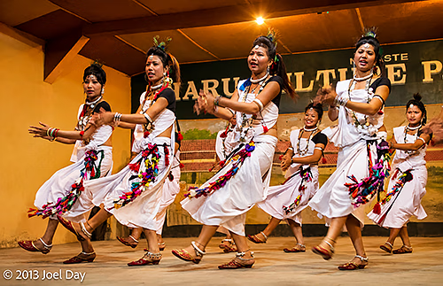
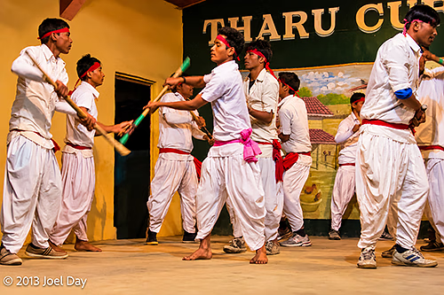
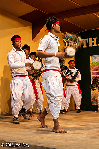
In the evening, they took me to a town hall where locals performed traditional dances for tourists. Most of the dances required tight coordination because sticks flew around, smacking into each other, each held by a different dancer. One wrong move and someone’s head was going to get split open. Fortunately, that didn’t happen!
Short Tour around Sauraha, Nepal
Map of the route “Pothead and Peacock Central”: 3,631 m, 32 m of climbing and 32 m of descent, elevation between 173 m and 179 m, time 01:58:16. It starts at 27.57710, 84.49511 and ends at 27.58218, 84.49397 (latitude, longitude).