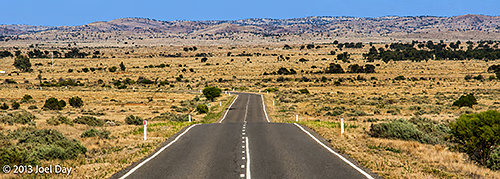
Interesting to compare my drive this time with the drive I did last time in 2004. Now I’m driving an SUV, which uses a bit more fuel than my little Corolla did. I seem to be carrying MUCH more stuff than I did last time, which is a bit of a pain. Among the items is my mountain bike, which has stayed in the back the entire time so far for various reasons (including security, fuel economy, and nasty road surfaces).
I have the aid of numerous GPS devices, but as far as navigation is concerned, they are really only best for micro views of where you are going and are a bit cumbersome to step back and get the big picture of where you are going for the day. Map books still lead the way in getting big-picture views of what is around. On the other hand, the GPS has been very good for sussing out all the service station options in small towns (where I have saved quite a bit tracking down the stations the locals use on back streets). They are also good for finding accommodation, shops, libraries, and other things.
Map of the route “Driving Differences”: 7,256 m, 82 m of climbing and 124 m of descent, elevation between -2 m and 62 m, time 16:59:01. It is a loop that starts and ends at -34.44791, 140.54859 (latitude, longitude).
It’s also been nice to have 4WD capabilities for some of the roads I’ve been on, and very nice to have cruise control. MP3 player as well? I actually had one of those installed in my little Corolla the last time I did a long road trip. Lots of hi-tech stuff, including my laptop – which makes it much easier to get photos on these blog posts! Most libraries I’ve found have free WiFi available these days.
