Australia, New South Wales

Machine Gun Sounds in the Forest

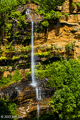
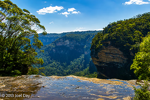
View from the top of a waterfall in Blue Mountains National Park, New South Wales

After hiking the National Pass Trail, I headed back down the other side of the mountains to find a campsite recommended to me by the Blue Mountains staff. They gave me a map and showed me the best scenic route, so I logged a few of the towns into my GPS to route me and give me an ETA. Seeing as it was only about an hour and 15 minutes, and the temperature back down in the valley was hovering around 100ºF (again), I decided to goof off a bit in the first historic town I came to – even grabbing dinner from a local cafe. When I hopped back into my car to drive what was supposed to be the last 15 minutes, I ended up in a suburban neighbourhood with NO national parks or campsites in sight! Major GPS failure. Or maybe the map was wrong. I haven’t determined which one yet, but I was finally able to punch in some GPS coordinates from a book I have on campsites for a site that appears to be roughly in the same location as the one recommended to me. The only problem was that it was a good hour’s drive down the road, and the sun was setting fast.

The Drive from Blue Mountains National Park to Abercrombie Karst Conservation Reserve

Map of the route “Machine Gun Sounds in the Forest”: 234,221 m, 3,522 m of climbing and 3,804 m of descent, elevation between 602 m and 1,164 m, time 07:56:15. It starts at -33.70970, 150.36952 and ends at -33.91600, 149.35855 (latitude, longitude).

It was a beautiful drive, and the kangaroos were starting to come out (major road hazard), but after an hour of driving, I came across one of the places the park staff had recommended – just as the sun was setting. It was down a long switchback road, a few kms off the main road I came in on, at a caving park. I arrived at the bottom to find no one around except one camper. Good enough for me, I pitched my tent and headed to bed soon afterwards.

What an amazing little find this turned out to be. As the light was getting low, I saw my first mainland wombat scurry across the field next to me. There was lots of activity overnight with all kinds of big strange sounds (the hopping kangaroos being the easiest to figure out). Nothing to worry about in Australia, as the mammals are rarely a problem for humans here. The stars were also amazing to see with no flies in my tent.
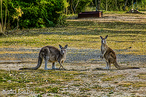
Kangaroos grazing at the Abercrombie Karst Conservation Reserve, New South Wales

In the morning, I heard my first lyrebird. The first time I heard about lyrebirds, I thought I was hearing an April Fool’s joke, but they really exist and can mimic any sound they hear. This one kept imitating the sound of a machine gun, so perhaps it had been hanging out at a local military training ground. I checked with the ranger in the morning, and he confirmed that it was what it was! In fact, it appears on the logos and badges of the New South Wales National Park Service.
Australia, New South Wales

The Smokey Blues

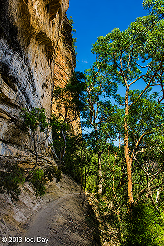
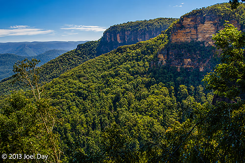
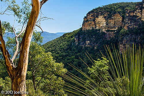
View from National Pass Trail along cliffs of the Blue Mountains National Park, New South Wales

Made a beeline for the famous Blue Mountains National Park just west of Sydney. After a cruisey drive down from Myall Lakes and into metropolitan Sydney, I encountered my first toll roads in Australia. Oddly enough, they didn’t have cash lanes, so I opted to set my GPS to avoid them. Sydney is a great city, but like most cities, it’s better seen without a car or gear in the back to worry about. I headed up into the mountains to see what I’ve often heard people talk about and what I regularly see out of my plane window when flying from Sydney to Perth.

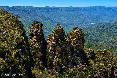
The Three Sisters at Echo Point in Blue Mountains National Park, New South Wales
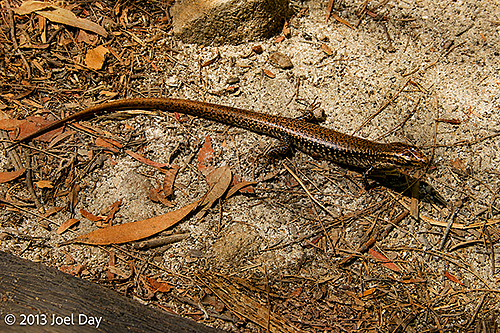
Skink in Blue Mountains National Park, New South Wales
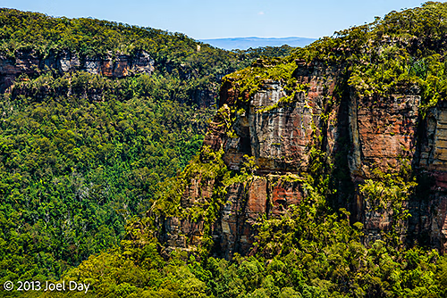
View from Echo Point in Blue Mountains National Park, New South Wales

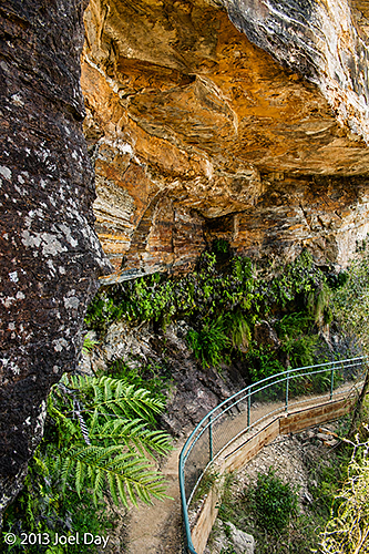
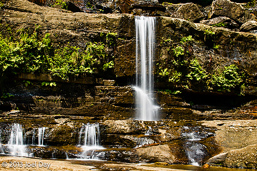
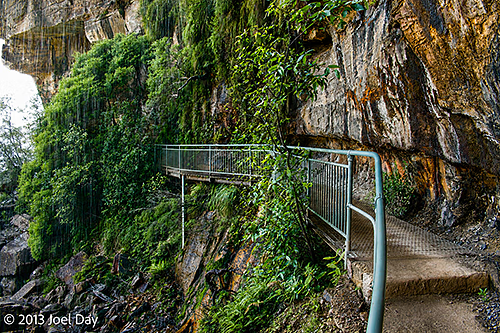
There had been fires in the area, and there was still a bit of lingering smoke, but the Blue Mountains lived up to their reputation. There are a number of lookout points you can drive to at the top, but there are also a variety of trails that drop down to different levels of the cliffs, passing by rivers and waterfalls along the way. I took one trail recommended to me by the park staff that dropped you halfway down the side of the cliff and along a ridge past waterfalls and amazing overlooks, until you reached a very steep staircase up the other side. It was called the National Pass Trail. A really amazing hike!

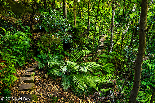
View of National Pass Trail along cliffs of the Blue Mountains National Park, New South Wales

National Pass Trail Hike

Map of the route “The Smokey Blues”: 8,112 m, 325 m of climbing and 316 m of descent, elevation between 695 m and 889 m, time 01:57:30. It is a loop that starts and ends at -33.72551, 150.36890 (latitude, longitude).

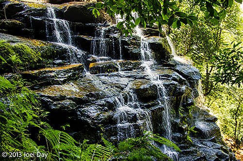
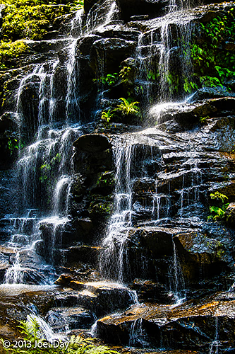
Waterfall along National Pass Trail in Blue Mountains National Park, New South Wales
National Pass Trail along cliffs of the Blue Mountains National Park, New South Wales
Waterfall along National Pass Trail in Blue Mountains National Park, New South Wales
National Pass Trail along cliffs of the Blue Mountains National Park, New South Wales
Waterfall along National Pass Trail in Blue Mountains National Park, New South Wales
View from National Pass Trail along cliffs of the Blue Mountains National Park, New South Wales
Waterfall along National Pass Trail in Blue Mountains National Park, New South Wales
Australia, New South Wales

Foolproof Speedtraps

Interestingly, there were numerous sections of highways in New South Wales where average speeds were calculated by cameras. Sounds like the foolproof system for catching speeders. They have video cameras mounted over the highway lanes that read your license plates. They note when you’ve passed through and calculate the time it takes you to get through the next series of video cameras, 10 km (or so) down the road. If it finds you speeding, they just mail you your speeding ticket. Unlike point-based speed traps, you can’t slow down too fool the radars because your speed is calculated by the average you travelled over the 10 km. Very smart and effective, I think.

Today’s Drive

Map of the route “Foolproof Speedtraps”: 543,601 m, 6,636 m of climbing and 6,028 m of descent, elevation between -2 m and 1,164 m, time 26:40:42. It starts at -32.54963, 152.30718 and ends at -33.91417, 149.35861 (latitude, longitude).

Australia, New South Wales

Assateague Island with Dingoes instead of Wild Horses

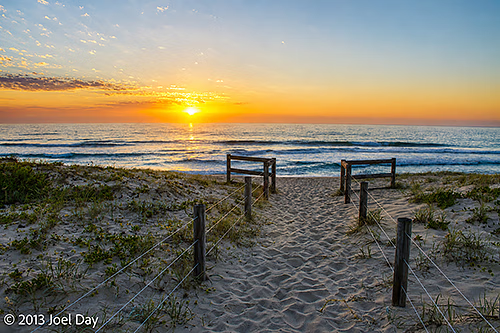
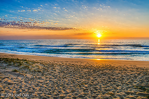
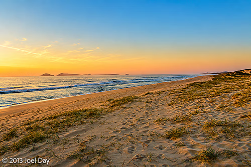
Mungo Beach, Myall Lakes National Park, New South Wales, at Dawn

Now that I’ve passed the eastern-most point in Australia (Byron Bay), every day’s drive will get me somewhat closer to Perth. I knew I had a long, tedious drive to do today, so I kicked off by riding my bike down to the beach for a swim with the local surfers. It was very nice, and I could have stayed there much longer than I did. Instead, I shot off to the local town for breakfast (something I was originally planning to do in Byron Bay) and then hit the tedious turnpike.

Today’s Drive

Map of the route “Assateague Island with Dingoes instead of Wild Horses”: 543,774 m, 3,393 m of climbing and 3,388 m of descent, elevation between 0 m and 135 m, time 22:05:28. It starts at -28.82456, 153.60100 and ends at -32.54969, 152.30772 (latitude, longitude).

Actually, it was a turnpike (toll road) and wasn’t as bad as I was expecting. It was quite busy, but limited to 2 lanes (1 in either direction) for most of it, with passing lanes opening up from time to time. It reminded me somewhat of the old coast road up from Bunbury to Perth before they opened up the freeway. There was a fair bit of construction underway because they are trying to expand the entire stretch to 4 lanes. Some sections were done and seemed very light on traffic, with 4 lanes.

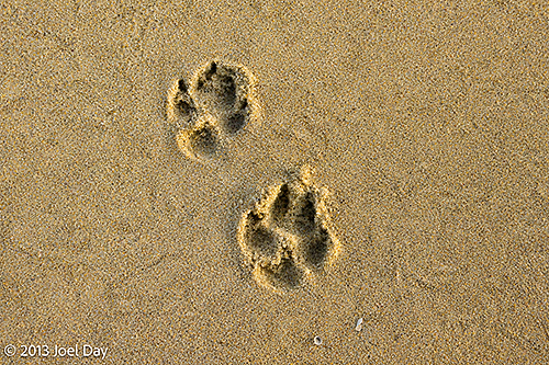
Dingo Prints on Mungo Beach, Myall Lakes National Park, New South Wales

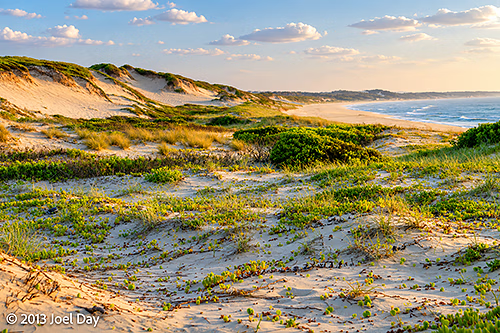
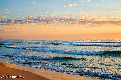
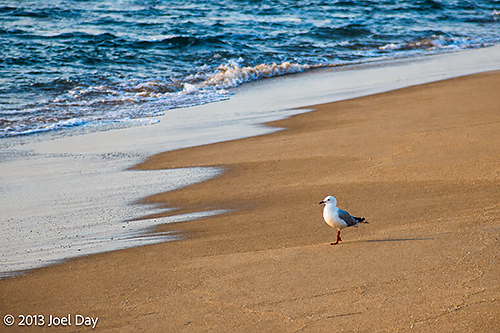
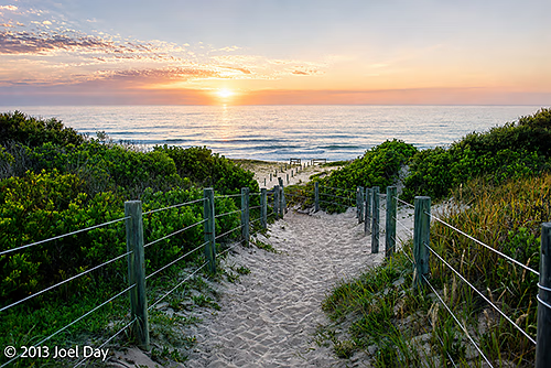
I finally arrived at my destination after catching another small ferry and found a campsite at Myall Lakes just over some sand dunes from a gorgeous, eternally long-looking beach. I pitched my tent and went for a swim – just to bookend my day with two beautiful swims. The beach somehow reminded me of Assateague Island, but with possible dingoes instead of wild horses. Found some mysterious paw prints in the sand the following morning.

Mungo Beach, Myall Lakes National Park, New South Wales, at Dawn
Australia, New South Wales, Queensland

Byron Breathalyzation

Feeling all revved up by my Lamington National Park stay, I hopped in my car and pursued what was supposed to be a two-hour drive down to Byron Bay for a night there. Byron Bay is a funky little alternative town everyone raves about, but when I finally got there, I could only find an eternally long traffic jam to get in, no accommodation available at any campsites for miles around, and a cop waiting to breathalyse me on the way back out. Not such a good experience. I did manage to find a caravan park several towns down the coast, which was wildly expensive, but only at the last minute.

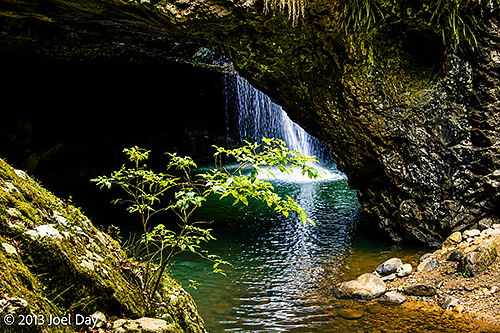
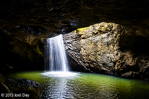
Natural Bridge Waterfall at Springbrook National Park, Queensland

Earlier in the day, on the way to Byron Bay, I did enjoy driving through some very spectacular mountain passes and visiting a national park with a waterfall flowing over and under a natural bridge.

Natural Bridge Waterfall Hike at Springbrook National Park, Queensland

Map of the route “Byron Breathalyzation”: 925 m, 45 m of climbing and 40 m of descent, elevation between 282 m and 318 m, time 00:16:54. It is a loop that starts and ends at -28.23088, 153.24279 (latitude, longitude).

Today’s Drive

Map of the route “Byron Breathalyzation”: 320,760 m, 4,462 m of climbing and 5,394 m of descent, elevation between -2 m and 1,000 m, time 07:57:33. It starts at -28.23025, 153.13240 and ends at -28.83151, 153.60167 (latitude, longitude).

Australia, Queensland

The benefits of hairy legs

Strangler Fig along trail in Lamington National Park, Queensland
Waterfall in rainforest at Lamington National Park, Queensland

After consulting with various friends about where to go next over the weekend, I set off around midday armed with my remaining highly recommended itinerary. First stop was Lamington National Park, a national park on the southern border of Queensland, up in the mountains.

Hiking trail through rainforest in Lamington National Park, Queensland

I managed to find a nice little spot for my tent, even though it was meant for campervans. Up in the mountains, it was actually pretty cold overnight, but I had plenty of warm clothes to rug up in. There were quite a few hiking trails along rainforest ridges and down into valleys past beautiful waterfalls. I only had time to do an elevated treetop walk on the day I arrived and a 12km forest/waterfall loop the morning before I left. A very nice hike that descended into a river valley and crisscrossed past various waterfalls.

Colourful berries and leaves on the floor of rainforest at Lamington National Park, Queensland
Strangler Fig and ferns along trail in Lamington National Park, Queensland
Fungi on the floor of rainforest at Lamington National Park, Queensland
Moss and ferns on tree in rainforest in Lamington National Park, Queensland
View from Lamington National Park, Queensland

Saw quite a bit of interesting wildlife, but I didn’t care much for the perpetual onset of leeches at the riverbanks. They look like little black inchworms, and they move very quickly up your legs, looking for a spot to dig into. Fortunately, the hair on my legs would tickle when they attempted to climb me, so I was able to quickly find each one and flick it off before it bit me.

Southern Angle-headed Dragon (Lophosaurus spinipes) camouflaged on floor of rainforest in Lamington National Park, Queensland

Lamington National Park Rainforest Hike

Map of the route “The benefits of hairy legs”: 11,597 m, 419 m of climbing and 423 m of descent, elevation between 682 m and 949 m, time 03:25:24. It is a loop that starts and ends at -28.23029, 153.13233 (latitude, longitude).

The Drive from Brisbane to Lamington National Park

Map of the route “The benefits of hairy legs”: 124,707 m, 1,868 m of climbing and 1,022 m of descent, elevation between 27 m and 911 m, time 14:49:26. It starts at -27.48141, 152.99362 and ends at -28.22866, 153.13244 (latitude, longitude).

Australia, Queensland

Weekend in Brisbane

Had a great time catching up with friends in Brisbane. Some I knew were there, and others I didn’t. I also enjoyed a bit of hiking in a local national park, exploring bits of the town, visiting museums, and snooping around various trendy neighbourhoods. We did most of our transportation in and around town via speedy river ferries, which were pretty cool. The thing to do in Queensland cities, it seems, is to open a free public pool in the busiest tourist part of town. Arlie Beach, Cairns, and Brisbane all had them.

View of Brisbane, Queensland, from Mt Coot-tha Summit Lookout
Tourists viewing Brisbane, Queensland, from Mt Coot-tha Summit Lookout

Decided to scrub down my car after 10,000 kilometres of caked-on dirt. It wasn’t easy finding a place where you could do it yourself, but I finally found one. Once I got there, I naturally needed a bit of time to get all the mud off. By the time I was finished, a long line of people waiting in line behind me were beginning to give me disgruntled looks.

Art from Mt Coot-tha Aboriginal Art Trail, Brisbane, Queensland
Ferris Wheel in Brisbane, Queensland
River Cruise on Brisbane River, Queensland
Nighttime River Cruise on Brisbane River, Queensland

Mt Coot-tha Summit Hike (second half of)

Map of the route “Weekend in Brisbane”: 2,902 m, 101 m of climbing and 210 m of descent, elevation between 85 m and 223 m, time 01:18:11. It starts at -27.48390, 152.95971 and ends at -27.47442, 152.96481 (latitude, longitude).

Brisbane River Cruise with Dinner

Map of the route “Weekend in Brisbane”: 15,343 m, 44 m of climbing and 46 m of descent, elevation between -10 m and 6 m, time 01:42:02. It starts at -27.47993, 153.01235 and ends at -27.48249, 152.99648 (latitude, longitude).

Australia, Queensland

Boston meets San Francisco

Brisbane, Queensland

On my 1-month anniversary of starting my road trip from Adelaide, I was scheduled to drop in on some expat friends in Perth who have moved to Brisbane in the past few years and spend the weekend catching up with them and seeing the city for the first time.

On the way down, I dropped by a few beach spots, including Bridie Island, where I had my first nice swim in real surf without any crocs or jellyfish to worry about.

Point Cartwright Lighthouse Hike

Map of the route “Boston meets San Francisco”: 312 m, 4 m of climbing and 13 m of descent, elevation between 24 m and 33 m, time 00:04:20. It starts at -26.67954, 153.13845 and ends at -26.68173, 153.13724 (latitude, longitude).

Bridie Island Swim

Map of the route “Boston meets San Francisco”: 680 m, 264 m of climbing and 266 m of descent, elevation between -199 m and 3 m, time 00:10:36. It is a loop that starts and ends at -27.06188, 153.20250 (latitude, longitude).

The drive into Brisbane was quite amazing, with its labyrinth of roads and endless roller-coaster hills. There is no way I would have been able to figure out my way around if it weren’t for my GPS! Brisbane roads seemed to be a combination of San Francisco and Boston rolled into one. Even my friends there seemed to get a bit confused from time to time when trying to find their way around.

Today’s Drive

Map of the route “Boston meets San Francisco”: 217,810 m, 1,395 m of climbing and 1,370 m of descent, elevation between -12 m and 80 m, time 20:34:39. It starts at -26.88124, 153.04570 and ends at -27.46643, 152.98267 (latitude, longitude).

Australia, Queensland

Crikey!

Had one last night to camp before arriving in Brisbane to visit some friends and see the city. The area I camped in was quite beautiful, but the campground was another state forest full of bogans. After pitching my tent in what appeared to be a deserted campground, I ventured off to explore some of the sites in the area, including The Glasshouse Mountains and The Australia Zoo.

Glass House Mountains National Park near Brisbane, Queensland

The Glasshouse Mountains were really quite interesting, since they were actually volcanic plugs that were once below the earth’s surface but were not sticking up as mountains because of the erosion of the surrounding rock. There was a series of them in a line that James Cook spotted and named while exploring the area.

Glass House Mountains National Park near Brisbane, Queensland

Glass House Mountains National Park Hike

Map of the route “Crikey!”: 672 m, 41 m of climbing and 42 m of descent, elevation between -16 m and 25 m, time 00:13:40. It is a loop that starts and ends at -26.92674, 152.94027 (latitude, longitude).

The Australian Zoo was Steve “Crikey” Irwin’s base before he died and is still run by his surviving family. Not being a huge fan, I was a bit put off by what appeared to be too much emphasis on the family members as celebrities and not enough on wildlife. I was especially put off by the $60 price tag (!) to visit the place for the day. I spoke with several friends since I decided to skip it, and they all said it was quite good. For $60, I would have felt obligated to spend an entire day there – and that would have made it difficult to get into Brisbane during peak rush hour at the end of the day.

While I was out, the campsite quickly filled up with loud, boisterous bogans smoking dope and drinking too much beer in the evening. Some of them were actually trying to be quiet and friendly (perhaps to head off any complaints), but the combination of very hot weather, very high humidity, and very stagnant air made it difficult to sleep that night. Campfires made it especially bad because every time there was a slight breeze, it blew smoke into my tent and choked me out.

Bushfire near Glass House Mountains National Park near Brisbane, Queensland

Today’s Drive

Map of the route “Crikey!”: 221,800 m, 2,657 m of climbing and 2,803 m of descent, elevation between 3 m and 476 m, time 25:24:50. It starts at -26.64574, 152.64707 and ends at -26.87538, 153.04328 (latitude, longitude).

Australia, Queensland

Cannondale, meet Conondale; Conondale, meet Cannondale.

At last, a national park with actual mountain bike trails! They’re shared with horse trails and maintenance 4WD tracks, but at least they have SOMETHING here! So yes, I took my Cannondale mountain bike out for a spin in Conondale National Park this morning while it was still a bit cool. The only problem was that there were only two flavours of trails: straight up (Nanga Challenge style) or back and forth, meandering through river beds, which seemed to get progressively deeper. I did a bit of both, but didn’t last too long in the heatwave. At least I found a nice spot for a swim along the way.

Conondale National Park Mountain Biking

Map of the route “Cannondale, meet Conondale; Conondale, meet Cannondale.”: 6,220 m, 202 m of climbing and 198 m of descent, elevation between 120 m and 205 m, time 00:51:44. It is a loop that starts and ends at -26.61628, 152.65161 (latitude, longitude).

The Drive to Conondale

Map of the route “Cannondale, meet Conondale; Conondale, meet Cannondale.”: 224,776 m, 3,492 m of climbing and 4,347 m of descent, elevation between 118 m and 1,101 m, time 05:30:57. It starts at -26.88070, 151.59765 and ends at -26.64684, 152.64941 (latitude, longitude).